
Typhoon2000 STORM UPDATE #002
Name: TROPICAL STORM XANGSANE [MILENYO/18W/0615]
Issued: 7:00 PM MANILA TIME (11:00 GMT) TUE 26 SEPTEMBER 2006
Next Update: 7:00 AM (23:00 GMT) WED 27 SEPTEMBER 2006
Source: JTWC TROPICAL CYCLONE WARNING #004
_______________________________________________________________________
Next Update: 7:00 AM (23:00 GMT) WED 27 SEPTEMBER 2006
Source: JTWC TROPICAL CYCLONE WARNING #004
____________
TROPICAL STORM XANGSANE (MILENYO) INTENSIFYING RAPIDLY
AS IT DRIFTS ON A DANGEROUS PATH TOWARDS COASTAL BICOL
...STORM SIGNAL NUMBER TWO NOW RAISED.
...ALL INTERESTS IN THE BICOL, SAMAR, QUEZON & AURORA
PROVINCES SHOULD CLOSELY MONITOR THE PROGRESS OF TS
XANGSANE.
AS IT DRIFTS ON A DANGEROUS PATH TOWARDS COASTAL BICOL
...STORM SIGNAL NUMBER TWO NOW RAISED.
...ALL INTERESTS IN THE BICOL, SAMAR, QUEZON & AURORA
PROVINCES SHOULD CLOSELY MONITOR THE PROGRESS OF TS
XANGSANE.
+ FORECAST OUTLOOK: XANGSANE is expected to drift more
to the NW for the next 2 days parallel to the eastern
coast of Bicol Region and reaching Typhoon strength
Thursday afternoon, Sep 28. The core of the storm shall
pass more or less 50 km ENE of Catanduanes Island early
Thursday morning (Sep 28) & make landfall in the vicini-
ty of Baler, Aurora Thursday evening. The 3 to 5-day
(Sep 29 to Oct 1) Long-Range Forecast shows the storm
veering more Westward as it crosses Central Luzon
Friday morning (Sep 29) & finally moving out into the
South China Sea via La Union Saturday afternoon (Sep
South China Sea via La Union Saturday afternoon (Sep
30). XANGSANE shall then regain Typhoon status as it
heads for Hainan-Vietnam area by Sunday, Oct 1st.
+ EFFECTS: XANGSANE's inner bands are now along the
Eastern Coast of Samar...while its Outer Bands conti-
nues spread across Bicol Region, Samar, Leyte & Masbate.
Cloudy with moderate to heavy rains and winds not in
excess of 55 km/hr can be expected tonight along its
outer bands. Deteriorating weather conditions can be
expected tomorrow & Thursday along Bicol and Northern
Samar as XANGSANE approaches.
+ CURRENT MONSOON INTENSITY: The Southwest (SW) Monsoon
has awakened...currentl
now affecting Palawan, Western Mindanao and Rest of
Visayas. Cloudy skies with passing rains or thunder-
storms can be expected along the monsoon-affected
areas w/ southwesterly winds of 20 km/hr or higher.
outlook, effects & current monsoon intensity, and tropical
cyclone watch changes every 06 to 12 hours!
____________
TIME/DATE: 5:00 PM MANILA TIME (09:00 GMT) 26 SEPTEMBER
LOCATION OF CENTER: LATITUDE 12.2º N...LONGITUDE 127.1º E
DISTANCE 1: 275 KM (243 NM) ESE OF CATARMAN, NORTHERN SAMAR
DISTANCE 2: 340 KM (185 NM) SE OF VIRAC, CATANDUANES
DISTANCE 3: 380 KM (205 NM) ESE OF LEGAZPI CITY
DISTANCE 4: 450 KM (243 NM) ESE OF NAGA CITY
PEAK WIND GUSTS: 100 KM/HR (55 KTS)
SAFFIR-SIMPSON SCALE: N/A
MINIMUM CENTRAL PRESSURE (est.): 991 MILLIBARS (hPa)
RECENT MOVEMENT: WNW @ 11 KM/HR (06 KTS)
GENERAL DIRECTION: COASTAL BICOL REGION
STORM'S SIZE (IN DIAMETER): 445 KM (240 NM)/AVERAGE
MAX WAVE HEIGHT**: 16 FEET (4.8 METERS)
VIEW T2K TRACKING MAP: 5 PM PST TUE SEPTEMBER 26
TSR WIND PROBABILITIES: CURRENT TO 120 HRS LEAD
PHILIPPINE STORM SIGNALS*:
#02 - CATANDUANES, SORSOGON & SAMAR PROVINCES.
#01 - ALBAY, BURIAS ISLAND, CAMARINES PROVINCES, MASBATE,
TICAO ISLAND, LEYTE PROVINCES, BILIRAN ISLANDS,
CAMOTES ISLANDS, DINAGAT & SIARGAO ISLANDS.
12, 24 & 48 HR. FORECAST:
2 AM (18 GMT) 27 SEP: 12.7N 126.6E / 95-120 KPH / WNW @ 11 KPH
2 PM (06 GMT) 27 SEP: 13.5N 125.6E / 100-130 KPH / NW @ 11 KPH
2 PM (06 GMT) 28 SEP: 15.3N 123.1E / 120-150 KPH / NW @ 15 KPH
REMARKS: 2 PM (06 GMT) 26 SEPTEMBER POSITION: 12.1N 127.3E.
^TS XANGSANE IS CURRENTLY LOCATED IN A WEAKNESS OF THE SUB-
TROPICAL STEERING RIDGE CAUSED BY A DEEP MIDLATITUDE LOW
EAST OF KYUSHU. TS XANGSANE IS FORECAST TO TRACK SLOWLY
WEST-NORTHWESTWARD IN A WEAK STEERING ENVIRONMENT THROUGH
24 HOURS. AS THE MIDLATITUDE TROUGH MOVES EASTWARD, THE
STEERING RIDGE LOCATED NORTHEAST OF THE SYSTEM WILL BEGIN
TO BUILD WESTWARD. TS XANGSANE IS FORECAST TO ACCELERATE
AND TRACK NORTHWESTWARD ALONG THE SOUTHERN PERIPHERY OF
THE SUBTROPICAL STEERING RIDGE THROUGH 72 HOURS...
(more info)
>> XANGSANE {pronounced: xang~sa}, meaning: Elephant.
Name contributed by: Laos
____________
PAGASA CURRENT POSITION, MOVEMENT AND INTENSITY (10-min. ave.):
> 4 PM (08 GMT) 26 SEPTEMBER: 12.1N 127.1E / NW @ 07 KPH / 85 kph
:: For the complete PAGASA bulletin, kindly visit their website
at: http://www.pagasa.dost.gov.ph/wb/tcupdate.shtml
_______________________________________________________________________
:: For the complete PAGASA bulletin, kindly visit their website
at: http://www.pagasa.
____________
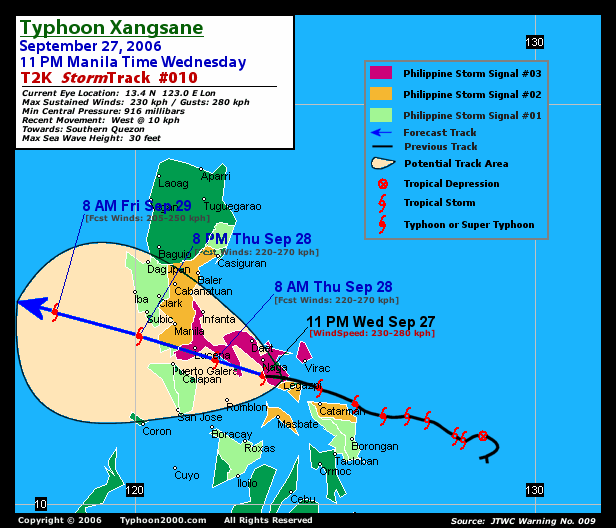
RECENT T2K TRACKING CHART:
________________________
RECENT MTSAT-1R SATELLITE IMAGE:

> Image source: Digital-Typhoon.org (Nat'l. Institute of Informatics) (http://www.digital-typhoon.org )
__________________________________________________________________________________________
NOTES:
> Image source: Digital-Typhoon.
^ - JTWC commentary remarks (for Meteorologists) from their
latest warning.
latest warning.
* - Based on PAGASA's Philippine Storm Warning Signals,
# 4 being the highest. Red letters indicate new areas
being hoisted. For more explanations on these signals,
visit: http://www.typhoon2000.ph/signals.htm
** - Based on the Tropical Cyclone's Wave Height near
its center.
__________________________________________________________________________________________
>> To know the meteorological terminologies and acronyms
used on this update visit the ff:
http://typhoon2000.ph/tcterm.htm
http://www.nhc.noaa.gov/aboutgloss.shtml
http://www.srh.noaa.gov/oun/severewx/glossary.php
http://www.srh.weather.gov/fwd/glossarynation.html
http://www.nhc.noaa.gov/acronyms.shtml
__________________________________________________________________________________________
:: Typhoon2000.com (T2K) Mobile >> Powered by: Synermaxx
Receive the latest storm updates directly to your mobile phones! To know more:
Send T2K HELP to: 2800 (GLOBE & TM) | 216 (SMART & TNT) | 2288 (SUN)
Note: Globe & Smart charges P2.50 per message, while Sun at P2.00.
__________________________________________________________________________________________
For the complete details on TS XANGSANE (MILENYO)...go visit
our website @:
> http://www.typhoon2000.com
> http://www.maybagyo.com
# 4 being the highest. Red letters indicate new areas
being hoisted. For more explanations on these signals,
visit: http://www.typhoon2
** - Based on the Tropical Cyclone's Wave Height near
its center.
____________
>> To know the meteorological terminologies and acronyms
used on this update visit the ff:
http://typhoon2000.
http://www.nhc.
http://www.srh.
http://www.srh.
http://www.nhc.
____________
:: Typhoon2000.
Receive the latest storm updates directly to your mobile phones! To know more:
Send T2K HELP to: 2800 (GLOBE & TM) | 216 (SMART & TNT) | 2288 (SUN)
Note: Globe & Smart charges P2.50 per message, while Sun at P2.00.
For the complete details on TS XANGSANE (MILENYO)...
our website @:
> http://www.typhoon2
> http://www.maybagyo
Change settings via the Web (Yahoo! ID required)
Change settings via email: Switch delivery to Daily Digest | Switch format to Traditional
Visit Your Group | Yahoo! Groups Terms of Use | Unsubscribe
SPONSORED LINKS
.
__,_._,___

No comments:
Post a Comment