Typhoon2000 STORM UPDATE #014
Name: TYPHOON SHANSHAN [LUIS/14W/0613]
Issued: 7:00 AM MANILA TIME (23:00 GMT) SUN 17 SEPTEMBER 2006
Next Update: 7:00 PM (11:00 GMT) SUN 17 SEPTEMBER 2006
Source: JTWC TROPICAL CYCLONE WARNING #028
_______________________________________________________________________
Next Update: 7:00 PM (11:00 GMT) SUN 17 SEPTEMBER 2006
Source: JTWC TROPICAL CYCLONE WARNING #028
____________
POWERFUL TYPHOON SHANSHAN (LUIS) WEAKENS BUT STILL A
DANGEROUS CATEGORY THREE SYSTEM...TO STRIKE KYUSHU,
JAPAN TONIGHT.
DANGEROUS CATEGORY THREE SYSTEM...TO STRIKE KYUSHU,
JAPAN TONIGHT.
+ FORECAST OUTLOOK: SHANSHAN is expected to continue acce-
lerating NE for the next 24 hours and make landfall over
Western Kyushu, passing very close to the South of Sasebo,
Japan tonight. The typhoon is forecast to accelerate fur
ther as it transforms into Extratropical while crossing
the rugged terrain of Northern Kyushu and NW Honshu early
tomorrow morning (Sep 18). It shall become an Extratropical
Cyclone tomorrow Monday afternoon. All interests in South
Korea & the main Japanese Islands of Kyushu & Western
Honshu should closely monitor the progress of this
dangerous typhoon.
+ EFFECTS: The typhoon's inner bands now entering the coast
of Western Honshu, while the core is likely to reach the
area this afternoon. Kindly refer to EPFT shown below for
its estimated time of arrival. Meanwhile, Outer bands cu-
rrently affecting South Korea, Sea of Japan, Ryukyu Islands
and the northern coasts of Japan. Moderate to heavy rains
with damaging typhoon-force winds in excess of 100 km/hr
can be expected along its inner bands with diminishing winds
and rains through its outer bands. Precautionary measures
must be fully implemented, along the affected areas. Coastal
Storm Surge flooding of 9 to 12 feet above normal tide
levels...along with large and dangerous battering waves can
be expected near and to the north or east of where the center
of Shanshan makes landfall in Kyushu.
+ CURRENT MONSOON INTENSITY: N/A.
+ TROPICAL CYCLONE WATCH: The active Tropical Disturbance
(LPA/96W/1004 mb) over the Eastern Marianas has been moving
Eastward over the past 3 hours and was estimated about 1,330
km NE of Saipan (20.0N 157.1E)...packing sustained winds of
40 km/hr. This disturbance will likely to become a Tropical
Depression any time now.
Important Note: Please keep in mind that the above forecast
outlook, effects & current monsoon intensity, and tropical
cyclone watch changes every 06 to 12 hours!
____________
TIME/DATE: 5:00 AM MANILA TIME (21:00 GMT) 17 SEPTEMBER
LOCATION OF EYE: LATITUDE 29.4º N...LONGITUDE 127.7º E
DISTANCE 1: 325 KM (175 NM) NORTH OF OKINAWA, JAPAN
DISTANCE 2: 430 KM (232 NM) SE OF NAGASAKI, TAIWAN
DISTANCE 3: 370 KM (200 NM) SW OF KAGOSHIMA, JAPAN
DISTANCE 4: 470 KM (253 NM) SSE OF CHEJU ISLAND
MAX SUSTAINED WINDS [1-MIN AVG]: 195 KM/HR (105 KTS)
PEAK WIND GUSTS: 240 KM/HR (130 KTS)
SAFFIR-SIMPSON SCALE: CATEGORY THREE (3)
MINIMUM CENTRAL PRESSURE (est.): 938 MILLIBARS (hPa)
RECENT MOVEMENT: NE @ 33 KM/HR (18 KTS)
GENERAL DIRECTION: KYUSHU, JAPAN
STORM'S SIZE (IN DIAMETER): 740 KM (400 NM)/LARGE
MAX WAVE HEIGHT**: 28 FEET (8.5 METERS)
VIEW TRACKING MAP: 3 AM JST TIME SUN SEPTEMBER 17
TSR WIND PROBABILITIES: CURRENT TO 36 HRS LEAD
PHILIPPINE STORM SIGNALS*:
#01 - NOW LOWERED...
12, 24 & 36 HR. FORECAST:
> 2 PM (06 GMT) 17 SEPTEMBER: 31.6N 129.3E / 160-195 KPH
> 2 AM (18 GMT) 18 SEPTEMBER: 35.3N 131.7E / 110-140 KPH
> 2 PM (06 GMT) 18 SEPTEMBER: 39.8N 135.9E / 95-120 KPH [XT]
REMARKS: 2 AM (18 GMT) 17 SEPTEMBER POSITION: 28.6N 127.1E.
^TY SHANSHAN HAS CONTINUED TO INCREASE SPEED TOWARDS THE
NORTHEAST AS A MIDLATITUDE LOW PRESSURE TROUGH DEEPENING
OVER EASTERN CHINA INTERACTS WITH THE SYSTEM. TY SHANSHAN
IS FORECAST TO TRACK NORTHEASTWARD WITH FURTHER SPEED
INCREASES AS IT BECOMES EMBEDDED IN THE MIDLATITUDE FLOW.
THE STORM IS FORECAST TO BEGIN UNDERGOING EXTRATROPICAL
TRANSITION BY 12 HOURS AND BE FULLY EXTRATROPICAL BY 36
HOURS...(more info)
>> SHANSHAN {pronounced: sarn~sarn}, meaning: A fairly
common pet name for young girls. Name contributed
by: Hong Kong, China
_______________________________________________________________________
EYEWALL PASSAGE FORECAST TIMES (EPFT):
+ Sasebo-Nagasaki: 4PM until 11PM JST tonight.
Note: The EyeWall - is the ring of rain clouds surrounding the "EYE" of a Typhoon.
It is here where the strongest winds and heaviest rain of a typhoon can be found.
EPFT will show what local times on a given area the most damaging winds and
heaviest rainfall could be experienced. EPFT changes everytime a new warning
synopsis is issued. Important: This is only an estimate analysis, do not use this
for life or death decisions.
_________________________________________________________________________________
RECENT WEATHER UNDERGROUND TRACKING CHART:
REMARKS: 2 AM (18 GMT) 17 SEPTEMBER POSITION: 28.6N 127.1E.
^TY SHANSHAN HAS CONTINUED TO INCREASE SPEED TOWARDS THE
NORTHEAST AS A MIDLATITUDE LOW PRESSURE TROUGH DEEPENING
OVER EASTERN CHINA INTERACTS WITH THE SYSTEM. TY SHANSHAN
IS FORECAST TO TRACK NORTHEASTWARD WITH FURTHER SPEED
INCREASES AS IT BECOMES EMBEDDED IN THE MIDLATITUDE FLOW.
THE STORM IS FORECAST TO BEGIN UNDERGOING EXTRATROPICAL
TRANSITION BY 12 HOURS AND BE FULLY EXTRATROPICAL BY 36
HOURS...(more info)
>> SHANSHAN {pronounced: sarn~sarn}, meaning: A fairly
common pet name for young girls. Name contributed
by: Hong Kong, China
____________
EYEWALL PASSAGE FORECAST TIMES (EPFT):
+ Sasebo-Nagasaki: 4PM until 11PM JST tonight.
Note: The EyeWall - is the ring of rain clouds surrounding the "EYE" of a Typhoon.
It is here where the strongest winds and heaviest rain of a typhoon can be found.
EPFT will show what local times on a given area the most damaging winds and
heaviest rainfall could be experienced. EPFT changes everytime a new warning
synopsis is issued. Important: This is only an estimate analysis, do not use this
for life or death decisions.
RECENT WEATHER UNDERGROUND TRACKING CHART:
Track Source: The Weather Underground Tropical Page (http://www.wundergr
________________________
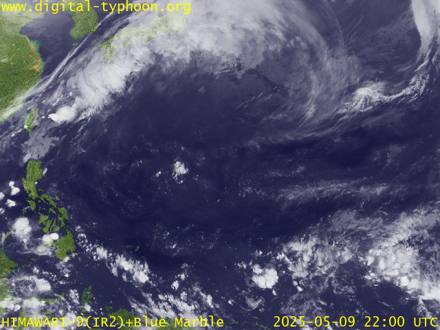
RECENT MTSAT-1R SATELLITE IMAGE:

> Image source: Digital-Typhoon.org (Nat'l. Institute of Informatics) (http://www.digital-typhoon.org )
__________________________________________________________________________________________
NOTES:

> Image source: Digital-Typhoon.
^ - JTWC commentary remarks (for Meteorologists) from their
latest warning.
latest warning.
* - Based on PAGASA's Philippine Storm Warning Signals,
# 4 being the highest. Red letters indicate new areas
being hoisted. For more explanations on these signals,
visit: http://www.typhoon2000.ph/signals.htm
** - Based on the Tropical Cyclone's Wave Height near
its center.
__________________________________________________________________________________________
>> To know the meteorological terminologies and acronyms
used on this update visit the ff:
http://typhoon2000.ph/tcterm.htm
http://www.nhc.noaa.gov/aboutgloss.shtml
http://www.srh.noaa.gov/oun/severewx/glossary.php
http://www.srh.weather.gov/fwd/glossarynation.html
http://www.nhc.noaa.gov/acronyms.shtml
__________________________________________________________________________________________
:: Typhoon2000.com (T2K) Mobile >> Powered by: Synermaxx
Receive the latest storm updates directly to your mobile phones! To know more:
Send T2K HELP to: 2800 (GLOBE & TM) | OFFLINE (SMART & TNT) | 2288 (SUN)
Note: Globe & Smart charges P2.50 per message, while Sun at P2.00.
__________________________________________________________________________________________
For the complete details on TY SHANSHAN (LUIS)...go visit
our website @:
> http://www.typhoon2000.com
> http://www.maybagyo.com
# 4 being the highest. Red letters indicate new areas
being hoisted. For more explanations on these signals,
visit: http://www.typhoon2
** - Based on the Tropical Cyclone's Wave Height near
its center.
____________
>> To know the meteorological terminologies and acronyms
used on this update visit the ff:
http://typhoon2000.
http://www.nhc.
http://www.srh.
http://www.srh.
http://www.nhc.
____________
:: Typhoon2000.
Receive the latest storm updates directly to your mobile phones! To know more:
Send T2K HELP to: 2800 (GLOBE & TM) | OFFLINE (SMART & TNT) | 2288 (SUN)
Note: Globe & Smart charges P2.50 per message, while Sun at P2.00.
For the complete details on TY SHANSHAN (LUIS)...go visit
our website @:
> http://www.typhoon2
> http://www.maybagyo
Change settings via the Web (Yahoo! ID required)
Change settings via email: Switch delivery to Daily Digest | Switch format to Traditional
Visit Your Group | Yahoo! Groups Terms of Use | Unsubscribe
SPONSORED LINKS
.
__,_._,___
No comments:
Post a Comment