Typhoon2000 STORM UPDATE #008
Name: TYPHOON STORM SOULIK [21W/0618]
Issued: 7:00 AM MANILA TIME (23:00 GMT) FRI 13 OCTOBER 2006
Next Update: 7:00 PM (11:00 GMT) FRI 13 OCTOBER 2006
Source: JTWC TROPICAL CYCLONE WARNING #016
_______________________________________________________________________
Next Update: 7:00 PM (11:00 GMT) FRI 13 OCTOBER 2006
Source: JTWC TROPICAL CYCLONE WARNING #016
____________
SOULIK (21W) BECOMES THE 11TH TYPHOON OF THE 2006 SEASON...
MOVING WEST-NORTHWEST VERY SLOWLY...STRONG WINDS AND
HEAVY RAINS AFFECTING THE TINY ISLAND OF IWO JIMA.
...ALL INTERESTS IN THE IWO JIMA, RYUKYUS (OKINAWA) AND
SOUTHERN JAPAN SHOULD CLOSELY MONITOR THE PROGRESS OF
SOULIK.
MOVING WEST-NORTHWEST VERY SLOWLY...STRONG WINDS AND
HEAVY RAINS AFFECTING THE TINY ISLAND OF IWO JIMA.
...ALL INTERESTS IN THE IWO JIMA, RYUKYUS (OKINAWA) AND
SOUTHERN JAPAN SHOULD CLOSELY MONITOR THE PROGRESS OF
SOULIK.
+ FORECAST OUTLOOK: SOULIK is expected to continue moving
very slowly WNW for the next 24 hours & shall turn North-
ward within the 36 to 48 hour period, then becoming a
175-km/hr Category 2 Typhoon. The eye is now on its clo-
sest approach to Iwo Jima. The 3 to 5-day long range
forecast (Oct 16-18) shows SOULIK rapidly accelerating
towards the NE early next week, after a passing mid-lati-
tude low pressure erodes the high pressure ridge & pulls
the typhoon away from Iwo Jima Area. This forecast out-
look still suggests a decreasing threat to Southeastern
Japan as it shall remain over the open waters of the NW
Pacific.
+ EFFECTS: SOULIK's northern inner bands will continue to
affect Iwo Jima and nearby islands today. Moderate to
heavy rains with strong ENE to Easterly winds not excee-
ding 100 km/hr can be expected today. Typhoon conditions
shall continue to prevail over Iwo Jima for the next 2 to
3 days due to its very slow movement of Soulik. Meanwhile,
Bonin Island is under the typhoon's outer bands. Coastal
Storm Surge flooding of 4 to 5 feet above normal tide
levels...along with large and dangerous battering waves
can be expected along Iwo Jima and nearby islands.
+ CURRENT MONSOON INTENSITY: Southwesterly windflow en-
hanced by SOULIK continues to bring cloudy skies with
rainshowers & thunderstorms across the Marianas.
outlook, effects & current monsoon intensity, and tropical
cyclone watch changes every 06 to 12 hours!
____________
TIME/DATE: 5:00 AM MANILA TIME (21:00 GMT) 13 OCTOBER
LOCATION OF EYE: LATITUDE 23.6º N...LONGITUDE 140.6º E
DISTANCE 1: 150 KM (80 NM) SW OF IWO JIMA
DISTANCE 2: 1,310 KM (708 NM) ESE OF OKINAWA, JAPAN
PEAK WIND GUSTS: 160 KM/HR (85 KTS)
SAFFIR-SIMPSON SCALE: N/A
MINIMUM CENTRAL PRESSURE (est.): 972 MILLIBARS (hPa)
RECENT MOVEMENT: WNW @ 07 KM/HR (04 KTS)
GENERAL DIRECTION: IWO JIMA AREA
STORM'S SIZE (IN DIAMETER): 850 KM (460 NM)/LARGE
MAX WAVE HEIGHT**: 27 FEET (8.2 METERS)
VIEW TRACKING MAP: 3 AM JST FRI OCTOBER 13
TSR WIND PROBABILITIES: CURRENT TO 120 HRS LEAD
PHILIPPINE STORM SIGNALS*: N/A
12, 24 & 48 HR. FORECAST:
2 PM (06 GMT) 13 OCT: 23.7N 140.3E / 150-185 KPH / WNW @ 05 KPH
2 AM (18 GMT) 14 OCT: 23.9N 140.0E / 160-195 KPH / NW @ 04 KPH
2 AM (18 GMT) 15 OCT: 25.3N 139.7E / 175-215 KPH / NORTH @ 09 KPH
DISTANCE 3: 1,945 KM (1,050 NM) ENE OF BATANES, PH
MAX SUSTAINED WINDS [1-MIN AVG]: 130 KM/HR (70 KTS)PEAK WIND GUSTS: 160 KM/HR (85 KTS)
SAFFIR-SIMPSON SCALE: N/A
MINIMUM CENTRAL PRESSURE (est.): 972 MILLIBARS (hPa)
RECENT MOVEMENT: WNW @ 07 KM/HR (04 KTS)
GENERAL DIRECTION: IWO JIMA AREA
STORM'S SIZE (IN DIAMETER): 850 KM (460 NM)/LARGE
MAX WAVE HEIGHT**: 27 FEET (8.2 METERS)
VIEW TRACKING MAP: 3 AM JST FRI OCTOBER 13
TSR WIND PROBABILITIES: CURRENT TO 120 HRS LEAD
PHILIPPINE STORM SIGNALS*: N/A
12, 24 & 48 HR. FORECAST:
2 PM (06 GMT) 13 OCT: 23.7N 140.3E / 150-185 KPH / WNW @ 05 KPH
2 AM (18 GMT) 14 OCT: 23.9N 140.0E / 160-195 KPH / NW @ 04 KPH
2 AM (18 GMT) 15 OCT: 25.3N 139.7E / 175-215 KPH / NORTH @ 09 KPH
REMARKS: 2 AM (18 GMT) 13 OCTOBER POSITION: 23.5N 140.7E.
^TY Soulik has taken a more northward track in the past 12
hours as a midlatitude low pressure shortwave trough tran-
sitioning through the longwave pattern has created a weak-
ness in the steering ridge to the northeast of the storm.
The shortwave trough is quickly lifting northeastward,
leaving TY Soulik under the influence of competing steering
ridges to the east and west of the storm. In the absence
of a singular strong steering influence, TY Soulik will
slow considerably through the first 48 hours of the forecast
period. After 48 hours, an approaching mid-latitude trough
currently over eastern China will facilitate recurvature.
(more info)
>> SOULIK {pronounced: sow~lick}, meaning: Traditional Pohnpei
Chief's title. Name contributed by: Micronesia
____________
_______________________________________________________________________
RECENT WUNDERGROUND.
________________________
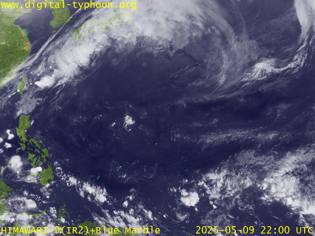
RECENT MTSAT-1R SATELLITE IMAGE:

> Image source: Digital-Typhoon.org (Nat'l. Institute of Informatics) (http://www.digital-typhoon.org )
__________________________________________________________________________________________
NOTES:

> Image source: Digital-Typhoon.
^ - JTWC commentary remarks (for Meteorologists) from their
latest warning.
latest warning.
* - Based on PAGASA's Philippine Storm Warning Signals,
# 4 being the highest. Red letters indicate new areas
being hoisted. For more explanations on these signals,
visit: http://www.typhoon2000.ph/signals.htm
** - Based on the Tropical Cyclone's Wave Height near
its center.
__________________________________________________________________________________________
>> To know the meteorological terminologies and acronyms
used on this update visit the ff:
http://typhoon2000.ph/tcterm.htm
http://www.nhc.noaa.gov/aboutgloss.shtml
http://www.srh.noaa.gov/oun/severewx/glossary.php
http://www.srh.weather.gov/fwd/glossarynation.html
http://www.nhc.noaa.gov/acronyms.shtml
__________________________________________________________________________________________
:: Typhoon2000.com (T2K) Mobile >> Powered by: Synermaxx
Receive the latest storm updates directly to your mobile phones! To know more:
Send T2K HELP to: 2800 (GLOBE & TM) | 216 (SMART & TNT) | 2288 (SUN)
Note: Globe & Smart charges P2.50 per message, while Sun at P2.00.
Offline Status: Servers under migration to a new location..services will resume
October 16 or 17 (Monday or Tuesday). Sorry for the inconvenience.
__________________________________________________________________________________________
For the complete details on TY SOULIK (21W)...go visit
our website @:
> http://www.typhoon2000.com
> http://www.maybagyo.com
# 4 being the highest. Red letters indicate new areas
being hoisted. For more explanations on these signals,
visit: http://www.typhoon2
** - Based on the Tropical Cyclone's Wave Height near
its center.
____________
>> To know the meteorological terminologies and acronyms
used on this update visit the ff:
http://typhoon2000.
http://www.nhc.
http://www.srh.
http://www.srh.
http://www.nhc.
____________
:: Typhoon2000.
Receive the latest storm updates directly to your mobile phones! To know more:
Send T2K HELP to: 2800 (GLOBE & TM) | 216 (SMART & TNT) | 2288 (SUN)
Note: Globe & Smart charges P2.50 per message, while Sun at P2.00.
Offline Status: Servers under migration to a new location..services will resume
October 16 or 17 (Monday or Tuesday). Sorry for the inconvenience.
____________
For the complete details on TY SOULIK (21W)...go visit
our website @:
> http://www.typhoon2
> http://www.maybagyo
Change settings via the Web (Yahoo! ID required)
Change settings via email: Switch delivery to Daily Digest | Switch format to Traditional
Visit Your Group | Yahoo! Groups Terms of Use | Unsubscribe
SPONSORED LINKS
.
__,_._,___
No comments:
Post a Comment