Typhoon2000 STORM UPDATE #009
Name: TYPHOON MAN-YI [BEBENG/04W/0704]
Issued: 7:00 AM MANILA TIME (23:00 GMT) THU 12 JULY 2007
Next Update: 7:00 PM (11:00 GMT) THU 12 JULY
Source: JTWC TROPICAL CYCLONE WARNING #018
Next Update: 7:00 PM (11:00 GMT) THU 12 JULY
Source: JTWC TROPICAL CYCLONE WARNING #018
_______________________________________________________________________
TYPHOON MAN-YI (BEBENG) RAPIDLY INTENSIFIES OVER THE
PHILIPPINE SEA...NOW A 215-KM/HR CATEGORY 4 SYSTEM...
ACCELERATING NORTHWEST TOWARDS OKINAWA AREA.
+ FORECAST OUTLOOK: MAN-YI is expected to continue inten-PHILIPPINE SEA...NOW A 215-KM/HR CATEGORY 4 SYSTEM...
ACCELERATING NORTHWEST TOWARDS OKINAWA AREA.
sifying as it traverses the Northern Philippine Sea &
shall move in a generally NW'ly track for the next 24
hours before turning North tomorrow. Majority of the com-
puter forecast models continue to show a path towards
Okinawa-Southern Japan area this weekend (Jul 13 to 15).
The 2 to 4-day long-range forecast (Jul 13 to 15) shows
the system reaching almost Super Typhoon strength with
winds of 230 km/hr tonight and shall pass over Okinawa,
Japan tomorrow morning, Friday the 13th (approx 11 AM HK
Time). It shall move NE to ENE passing along the beach-
front-coastal areas of Kyushu, Shikoku & Honshu. The eye
of MAN-YI is forecast to make landfall over Southern Hon-
shu or just to the South of Kyoto, Japan by early Sunday
morning, Jul 15. MAN-YI is likely to become an Extratro-
pical Cyclone after crossing the coastal areas of Honshu,
Japan (early Monday morning, Jul 16.
+ EFFECTS: MAN-YI's over-all circulation remains large and
continues to cover most of the Philippine Sea. Its outer
bands is expected to reach Okinawa and the Ryukyus today.
Overcast skies with moderate to heavy rains & gale-force
winds of 55-65 km/hr is expected. Coastal Storm Surge
flooding of 13 to 15 feet above normal tide levels...along
with large and dangerous battering waves can be expected
near and to the north of MAN-YI's projected path.
+ CURRENT MONSOON INTENSITY: Southwest (SW) Monsoon affec-
ting most of the Philippines today until Sat or Sun (Jul
14-15) as Typhoon MAN-YI contines to enhance it. Cloudy
skies with intermittent passing rains or thunderstorms can
be expected across the country w/ SW'ly winds of 30 km/hr
or higher, becoming more frequent along the Western sections
of Palawan and Western Visayas. Western Luzon and Metro Mani-
la may experience this monsoon system later today or tomorrow.
Mudslides and flooding is likely along river banks, low-lying
& flood-prone areas of Western Luzon & Western Visayas. Stay
tuned for more Monsoon updates in the coming hours.
+ TROPICAL CYCLONE WATCH: N/A.
Important Note: Please keep in mind that the above forecast
outlook, effects & current monsoon intensity, and tropical
cyclone watch changes every 06 to 12 hours!
____________
TIME/DATE: 5:00 AM MANILA TIME (21:00 GMT) 12 JULY
LOCATION OF EYE: LATITUDE 20.4º N...LONGITUDE 129.6º E
DISTANCE 1: 700 KM (378 NM) SSE OF OKINAWA, JAPAN
DISTANCE 2: 800 KM (430 NM) EAST OF BASCO, BATANES, PH
DISTANCE 3: 860 KM (465 NM) ENE OF APARRI, CAGAYAN, PH
DISTANCE 4: 1,015 KM (548 NM) NE OF NAGA CITY, PH
MAX SUSTAINED WINDS [1-MIN AVG]: 215 KM/HR (115 KTS)DISTANCE 4: 1,015 KM (548 NM) NE OF NAGA CITY, PH
PEAK WIND GUSTS: 260 KM/HR (140 KTS)
SAFFIR-SIMPSON SCALE: CATEGORY FOUR (4)
MINIMUM CENTRAL PRESSURE (est.): 927 MILLIBARS (hPa)
RECENT MOVEMENT: NW @ 31 KM/HR (17 KTS)
GENERAL DIRECTION: OKINAWA-KYUSHU AREA
STORM'S SIZE (IN DIAMETER): 1,165 KM (630 NM)/ VERY LARGE
MAX WAVE HEIGHT**: 31 FEET (9.4 METERS)
VIEW T2K TRACKING MAP: 5 AM MANILA TIME JULY 12
TSR WIND PROBABILITIES: CURRENT TO 96 HRS LEAD
PHILIPPINE STORM SIGNALS*: N/A
12 & 24 HR. FORECAST:
2 PM (06 GMT) 12 JULY: 22.3N 128.3E / 220-270 KPH / NNW @ 24 KPH
2 AM (18 GMT) 13 JULY: 24.8N 127.6E / 230-280 KPH / N @ 20 KPH
REMARKS: 2 AM (18 GMT) 12 JULY POSITION: 19.8N 130.0E.
^TYPHOON (TY) 04W (MAN-YI) HAS CONTINUED TO INTENSIFY AT
A CLIMATOLOGICAL RATE OVER THE PAST 24 HOURS. ANIMATED
ENHANCED IR SATELLITE IMAGERY DEPICTS A 85-KM ROUND EYE
WITH A BANDING FEATURE. A SSMIS MICROWAVE IMAGE INDICATES
A WELL-DEFINED EYE ENCLOSED BY DEEP CONVECTION. UPPER LEVEL
ANALYSIS AND ANIMATED WATER VAPOR IMAGERY INDICATE THAT TY
04W HAS MAINTAINED GOOD EQUATORWARD OUTFLOW OVER THE SOUTH-
WEST QUADRANT AND IS NOW UNDER THE INFLUENCE OF GOOD POLE-
WARD OUTFLOW CHANNEL ALLOWING IT TO INTENSIFY...(more)
>> MAN-YI {pronounced: mun~yi}, meaning: Name of a strait ori-
ginally. With the construction of a dam, that part of the
sea has become a reservoir. Name contributed by: Hong Kong.
____________
PAGASA CURRENT POSITION, MOVEMENT AND INTENSITY (10-min. ave.):
> 2 AM (18 GMT) 12 JULY: 19.9N 130.0E / NW @ 26 KPH / 140 kph
:: For the complete PAGASA bulletin, kindly visit their website
at: http://www.pagasa.dost.gov.ph/wb/tcupdate.shtml
:: For the complete PAGASA bulletin, kindly visit their website
at: http://www.pagasa.
_______________________________________________________________________
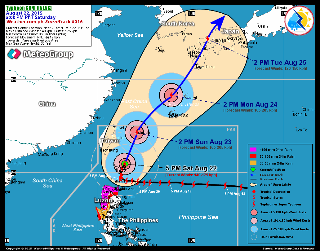
RECENT T2K TRACKING CHART:

________________________
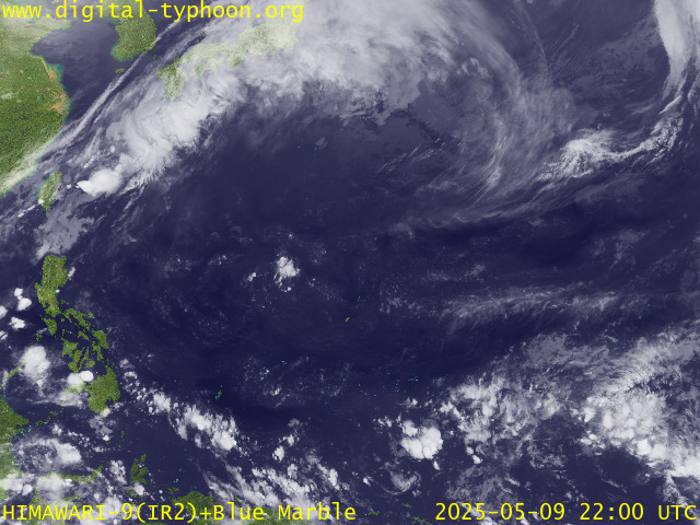
RECENT MTSAT-1R SATELLITE IMAGE:

> Image source: Digital-Typhoon.org (Nat'l. Institute of Informatics) (http://www.digital-typhoon.org )
__________________________________________________________________________________________
NOTES:

> Image source: Digital-Typhoon.
^ - JTWC commentary remarks (for Meteorologists) from their
latest warning.
latest warning.
* - Based on PAGASA's Philippine Storm Warning Signals,
# 4 being the highest. Red letters indicate new areas
being hoisted. For more explanations on these signals,
visit: http://www.typhoon2000.ph/signals.htm
** - Based on the Tropical Cyclone's Wave Height near
its center.
__________________________________________________________________________________________
>> To know the meteorological terminologies and acronyms
used on this update visit the ff:
http://typhoon2000.ph/tcterm.htm
http://www.nhc.noaa.gov/aboutgloss.shtml
http://www.srh.noaa.gov/oun/severewx/glossary.php
http://www.srh.weather.gov/fwd/glossarynation.html
http://www.nhc.noaa.gov/acronyms.shtml
__________________________________________________________________________________________
:: Typhoon2000.com (T2K) Mobile >> Powered by: Synermaxx
Receive the latest storm updates directly to your mobile phones! To know more:
Send T2K HELP to: 2800 (GLOBE & TM) | 216 (SMART & TNT) | 2288 (SUN)
Note: Globe & Smart charges P2.50 per message, while Sun at P2.00.
__________________________________________________________________________________________
For the complete details on Typhoon MAN-YI (BEBENG)...go visit
our website @:
> http://www.typhoon2000.com
> http://www.maybagyo.com
# 4 being the highest. Red letters indicate new areas
being hoisted. For more explanations on these signals,
visit: http://www.typhoon2
** - Based on the Tropical Cyclone's Wave Height near
its center.
____________
>> To know the meteorological terminologies and acronyms
used on this update visit the ff:
http://typhoon2000.
http://www.nhc.
http://www.srh.
http://www.srh.
http://www.nhc.
____________
:: Typhoon2000.
Receive the latest storm updates directly to your mobile phones! To know more:
Send T2K HELP to: 2800 (GLOBE & TM) | 216 (SMART & TNT) | 2288 (SUN)
Note: Globe & Smart charges P2.50 per message, while Sun at P2.00.
For the complete details on Typhoon MAN-YI (BEBENG)...go visit
our website @:
> http://www.typhoon2
> http://www.maybagyo
Change settings via the Web (Yahoo! ID required)
Change settings via email: Switch delivery to Daily Digest | Switch format to Traditional
Visit Your Group | Yahoo! Groups Terms of Use | Unsubscribe
SPONSORED LINKS
.
__,_._,___
No comments:
Post a Comment