
Typhoon2000 STORM UPDATE #003
Name: TYPHOON NARI [FALCON/12W/0711]
Issued: 7:00 AM MANILA TIME (23:00 GMT) SUN 16 SEPTEMBER 2007
Next Update: 7:00 PM (11:00 GMT) SUN 16 SEPTEMBER
Source: JTWC TROPICAL CYCLONE WARNING #013
Note: Kindly refer to your country's official warnings or bulletins. This update is for additional information purposes only.
Next Update: 7:00 PM (11:00 GMT) SUN 16 SEPTEMBER
Source: JTWC TROPICAL CYCLONE WARNING #013
Note: Kindly refer to your country's official warnings or bulletins. This update is for additional information purposes only.
_____________________________________________________________________________
TYPHOON NARI (FALCON)
APPROACHING THE ISLAND OF CHEJU AND SHALL MAKE LANDFALL OVER SOUTH KOREA TONIGHT.
+ FORECAST OUTLOOK: NARI is expected to pass over Cheju Island this
+ FORECAST OUTLOOK: NARI is expected to pass over Cheju Island this
afternoon around 1 PM Japan Standard Time (JST) and shall weaken further
as it makes landfall over the Southern part of South Korea tonight approx
9 PM JST. This system shall be downgraded into a Tropical Storm upon cro-
ssing South Korea early tomorrow morning (Mon Sept 17) and start transi-
tioning into an Extratropical Cyclone upon exiting the NE coast of South
Korea tomorrow. By tomorrow evening, NARI shall complete Extratropical
status while accelerating NE'ly across the cooler waters of the Sea of
Japan.
+ EFFECTS: NARI's core (eye and eywall) now moving across Cheju Island,
+ EFFECTS: NARI's core (eye and eywall) now moving across Cheju Island,
bringing typhoon force winds with moderate to heavy rains. Rain bands
affecting the whole Southern part of South Korea. Coastal Storm Surge
flooding of 4 to 5 feet above normal tide levels...along with large
and dangerous battering waves can be expected near and to the north of
NARI's projected path especially over Cheju Island & South Korea today.
Flash floods and mudslides are imminent along river banks, low-lying
and mountainous regions of the affected areas. Precautionary measures
must be initiated as the powerful system approaches.
Important Note: Please keep in mind that the above forecast outlook,
effects & current monsoon intensity, and tropical cyclone watch changes
every 06 to 12 hours!
_____________________________________________________________________________
TIME/DATE: 5:00 AM MANILA TIME (21:00 GMT) 16 SEPTEMBER
LOCATION OF EYE: LATITUDE 31.5º N...LONGITUDE 126.4º E
DISTANCE 1: 225 KM (122 NM) SOUTH OF CHEJU ISLAND
effects & current monsoon intensity, and tropical cyclone watch changes
every 06 to 12 hours!
____________
TIME/DATE: 5:00 AM MANILA TIME (21:00 GMT) 16 SEPTEMBER
LOCATION OF EYE: LATITUDE 31.5º N...LONGITUDE 126.4º E
DISTANCE 1: 225 KM (122 NM) SOUTH OF CHEJU ISLAND
DISTANCE 2: 475 KM (257 NM) ENE OF SHANGHAI, CHINA
DISTANCE 3: 470 KM (253 NM) SW OF PUSAN, SOUTH KOREA
MAX SUSTAINED WINDS [1-MIN AVG]: 165 KM/HR (90 KTS)
PEAK WIND GUSTS: 205 KM/HR (110 KTS)
SAFFIR-SIMPSON SCALE: CATEGORY TW0 (2)
MINIMUM CENTRAL PRESSURE (est.): 956 MILLIBARS (hPa)
RECENT MOVEMENT: NORTH @ 17 KM/HR (09 KTS)
GENERAL DIRECTION: CHEJU ISLAND-SOUTH KOREA
STORM'S SIZE (IN DIAMETER): 335 KM (180 NM)/SMALL-AVERAGE
MAX WAVE HEIGHT**: 25 FEET (7.6 METERS)
VIEW TRACKING MAP: 3 AM JAPAN TIME SUN SEPTEMBER 16
TSR WIND PROBABILITIES: CURRENT TO 48 HRS LEAD
PHILIPPINE STORM SIGNALS*: N/A
12, 24 & 48 HR. FORECAST:
2 PM (06 GMT) 16 SEPTEMBER: 33.2N 126.6E / 150-185 KPH / NNE @ 26 KPH
2 AM (18 GMT) 17 SEPTEMBER: 35.8N 127.7E / 95-120 KPH / NE @ 30 KPH
2 AM (18 GMT) 18 SEPTEMBER: 41.1N 134.8E / 55-75 KPH / NE @ 41 KPH
REMARKS: 2 AM (18 GMT) 16 SEPTEMBER POSITION: 30.9N 126.3E.
^TYPHOON (TY) 12W (NARI) HAS ACCELERATED AS IT HAS MOVED
NORTH OF THE SUBTROPICAL RIDGE AXIS AND INTO THE MIDLATITUDE
WESTERLIES. A 152126Z SSMI/S MICROWAVE PASS IS BEGINNING TO
INDICATE THE INTRUSION OF DRIER AIR ON THE WESTERN SIDE, AND
SOME LOSS OF CONVECTION ON THE SOUTHERN EYEWALL...(more)
>> NARI {pronounced: na~ri}, meaning: A lily. A kind of plant which
grows from a bulb, with large white or coloured flowers, commonly
found in Korea in summer. Name contributed by: Republic of Korea.
_____________________________________________________________________________
REMARKS: 2 AM (18 GMT) 16 SEPTEMBER POSITION: 30.9N 126.3E.
^TYPHOON (TY) 12W (NARI) HAS ACCELERATED AS IT HAS MOVED
NORTH OF THE SUBTROPICAL RIDGE AXIS AND INTO THE MIDLATITUDE
WESTERLIES. A 152126Z SSMI/S MICROWAVE PASS IS BEGINNING TO
INDICATE THE INTRUSION OF DRIER AIR ON THE WESTERN SIDE, AND
SOME LOSS OF CONVECTION ON THE SOUTHERN EYEWALL...(more)
>> NARI {pronounced: na~ri}, meaning: A lily. A kind of plant which
grows from a bulb, with large white or coloured flowers, commonly
found in Korea in summer. Name contributed by: Republic of Korea.
____________
_____________________________________________________________________________
RECENT TRACKING CHART:
RECENT TRACKING CHART:
________________________
RECENT MTSAT-1R SATELLITE IMAGE:
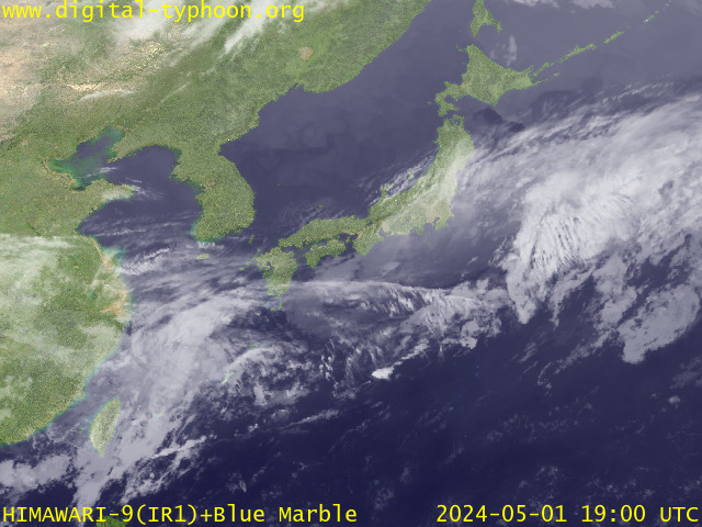
> Image source: Digital-Typhoon.org (Nat'l. Institute of Informatics) (http://www.digital-typhoon.org )
__________________________________________________________________________________________
NOTES:
> Image source: Digital-Typhoon.
^ - JTWC commentary remarks (for Meteorologists) from their
latest warning.
latest warning.
* - Based on PAGASA's Philippine Storm Warning Signals,
# 4 being the highest. Red letters indicate new areas
being hoisted. For more explanations on these signals,
visit: http://www.typhoon2000.ph/signals.htm
** - Based on the Tropical Cyclone's Wave Height near
its center.
__________________________________________________________________________________________
>> To know the meteorological terminologies and acronyms
used on this update visit the ff:
http://typhoon2000.ph/tcterm.htm
http://www.nhc.noaa.gov/aboutgloss.shtml
http://www.srh.noaa.gov/oun/severewx/glossary.php
http://www.srh.weather.gov/fwd/glossarynation.html
http://www.nhc.noaa.gov/acronyms.shtml
__________________________________________________________________________________________
:: Typhoon2000.com (T2K) Mobile >> Powered by: Synermaxx
Receive the latest storm updates directly to your mobile phones! To know more:
Send T2K HELP to: 2800 (GLOBE & TM) | 216 (SMART & TNT) | 2288 (SUN)
Note: Globe & Smart charges P2.50 per message, while Sun at P2.00.
__________________________________________________________________________________________
For the complete details on TY NARI (FALCON)...go visit
our website @:
> http://www.typhoon2000.com
> http://www.maybagyo.com
# 4 being the highest. Red letters indicate new areas
being hoisted. For more explanations on these signals,
visit: http://www.typhoon2
** - Based on the Tropical Cyclone's Wave Height near
its center.
____________
>> To know the meteorological terminologies and acronyms
used on this update visit the ff:
http://typhoon2000.
http://www.nhc.
http://www.srh.
http://www.srh.
http://www.nhc.
____________
:: Typhoon2000.
Receive the latest storm updates directly to your mobile phones! To know more:
Send T2K HELP to: 2800 (GLOBE & TM) | 216 (SMART & TNT) | 2288 (SUN)
Note: Globe & Smart charges P2.50 per message, while Sun at P2.00.
For the complete details on TY NARI (FALCON)...go visit
our website @:
> http://www.typhoon2
> http://www.maybagyo
Change settings via the Web (Yahoo! ID required)
Change settings via email: Switch delivery to Daily Digest | Switch format to Traditional
Visit Your Group | Yahoo! Groups Terms of Use | Unsubscribe
.
__,_._,___

No comments:
Post a Comment