Typhoon2000 STORM UPDATE #002
Name: TROPICAL STORM KROSA [INENG/17W/0715]
Issued: 7:00 PM MANILA TIME (11:00 GMT) TUE 02 OCTOBER 2007
Next Update: 7:00 AM (23:00 GMT) WED 03 OCTOBER
Source: JTWC TROPICAL CYCLONE WARNING NUMBER 004
Note: Kindly refer to your country's official warnings or bulletins. This update is for additional information purposes only.
Next Update: 7:00 AM (23:00 GMT) WED 03 OCTOBER
Source: JTWC TROPICAL CYCLONE WARNING NUMBER 004
Note: Kindly refer to your country's official warnings or bulletins. This update is for additional information purposes only.
_____________________________________________________________________________
TROPICAL STORM KROSA (INENG) STILL QUASI-STATIONARY...INTENSIFYING
RAPIDLY OVER THE PHILIPPINE
SEA...MAY BECOME A TYPHOON TONIGHT.RAPIDLY OVER THE PHILIPPINE
+ FORECAST OUTLOOK: INENG is expected to become a Typhoon late to-
night and start heading NW'ly at a slow pace for the next 24 hours,
accelerating slightly on Thursday Oct 4. The 3 to 5-day forecast
shows INENG maintaining its NW'ly track in the direction of Northern
Taiwan-Yaeyama Islands area. This system is likely to reach its peak
winds of 215 km/hr (Category 4) as it passes over Yaeyama Islands on
Sunday, Oct 07.
+ EFFECTS: KROSA's expanding circulation continues to improve and
+ EFFECTS: KROSA's expanding circulation continues to improve and
remains over the Philippine Sea - affecting only the shipping lanes.
Its SW and Western outer rainbands extends near the eastern coast of
Luzon but may soon affect the area, if the system moves closer to the
Philippines. Developing storm surge is possible along the above-
mentioned areas. Coastal Storm Surge flooding of 1 to 2 feet above
normal tide levels...along with large and dangerous battering waves
can be expected near and to the north of KROSA's projected path.
+ CURRENT ITCZ/MONSOON INTENSITY: Moderate to strong Southwest (SW)
+ CURRENT ITCZ/MONSOON INTENSITY: Moderate to strong Southwest (SW)
Monsoon enhanced by TS KROSA (INENG) located over the Philippine Sea -
will continue to bring mostly cloudy skies with intermittent rainfall
& SW'ly winds of 20 km/hr or higher across Western Philippines beco-
ming more frequent over Metro Manila, Zambales, Bataan, Mindoro, Lu-
bang Island, Western Visayas & Northern Palawan. Landslides and floo-
ding is likely to occur along steep mountain slopes, river banks,
low-lying & flood-prone areas of the affected areas, while big sea
waves or surges generated by this monsoon can affect the coastal
and beach-front areas of Western Visayas and Western Luzon.
Important Note: Please keep in mind that the above forecast outlook,
effects & current monsoon intensity, and tropical cyclone watch changes
every 06 to 12 hours!
_____________________________________________________________________________
TIME/DATE: 5:00 PM MANILA TIME (09:00 GMT) 02 OCTOBER
LOCATION OF CENTER: LATITUDE 16.8º N...LONGITUDE 131.4º E
DISTANCE 1: 995 KM (535 NM) ENE OF CASIGURAN, AURORA, PH
effects & current monsoon intensity, and tropical cyclone watch changes
every 06 to 12 hours!
____________
LOCATION OF CENTER: LATITUDE 16.8º N...LONGITUDE 131.4º E
DISTANCE 1: 995 KM (535 NM) ENE OF CASIGURAN, AURORA, PH
DISTANCE 2: 1,035 KM (560 NM) ESE OF TUGUEGARAO CITY, PH
DISTANCE 3: 1,045 KM (565 NM) ESE OF APARRI, CAGAYAN, PH
DISTANCE 4: 1,070 KM (578 NM) SE OF BASCO, BATANES, PH
DISTANCE 5: 1,130 KM (610 NM) ENE OF METRO MANILA, PH
PEAK WIND GUSTS: 140 KM/HR (75 KTS)
SAFFIR-SIMPSON SCALE: N/A
MINIMUM CENTRAL PRESSURE (est.): 978 MILLIBARS (hPa)
RECENT MOVEMENT: ENE @ 05 KM/HR (03 KTS)
GENERAL DIRECTION: PHILIPPINE SEA
STORM'S SIZE (IN DIAMETER): 720 KM (390 NM)/LARGE
MAX WAVE HEIGHT**: 17 FEET (5.1 METERS)
VIEW TRACKING MAP: 2 PM MANILA TIME TUE OCTOBER 02
TSR WIND PROBABILITIES: CURRENT TO 120 HRS LEAD
PHILIPPINE STORM SIGNALS*: N/A
12, 24 & 48 HR. FORECAST:
2 AM (18 GMT) 03 OCTOBER: 17.0N 131.4E / 130-160 KPH / NW @ 05 KPH
2 PM (06 GMT) 03 OCTOBER: 17.5N 130.9E / 150-185 KPH / NW @ 11 KPH
2 PM (06 GMT) 04 OCTOBER: 19.4N 129.0E / 175-215 KPH / NW @ 11 KPH
REMARKS: 2 PM (06 GMT) 02 OCTOBER POSITION: 16.7N 131.4E.
^TROPICAL STORM (TS) KROSA HAS CONTINUED TO CONSOLIDATE OVER
THE PAST 06 HOURS. THE SYSTEM WAS UPGRADED TO A TS ON THE 01/18Z
WARNING AND HAS CONTINUED TO IMPROVE WITH DEEP CONVECTION
DEVELOPING OVER A PREVIOUSLY EXPOSED LOW-LEVEL CIRCULATION
CENTER. ANIMATED MULTISPECTRAL SATELLITE IMAGERY DEPICTS A CDO
WITH EXCELLENT CONVECTIVE BANDING OVER THE SOUTHERN QUADRANT AS
WELL AS IMPROVING POLEWARD OUTFLOW ENHANCED BY AN UPPER LOW
EAST-NORTHEAST OF THE SYSTEM (23N 145E). MODEL GUIDANCE IS
ERRATIC BUT IN GENERAL SUPPORTS A NORTHWESTWARD TRACK. THIS
IS DUE IN LARGE PART TO THE WEAK STEERING ENVIRONMENT AND
RELATIVELY WEAK SYSTEM. ANIMATED WATER VAPOR IMAGERY INDICATES
THAT AN UPPER-LEVEL ANTICYCLONE HAS DEVELOPED OVER THE SYSTEM
CENTER WITH IMPROVING POLEWARD OUTFLOW ENHANCED BY THE UPPER LOW
EAST-NORTHEAST OF THE SYSTEM...(more)
>> KROSA {pronounced: kro~saah}, meaning: Crane.
Name contributed by: Cambodia.
_____________________________________________________________________________
REMARKS: 2 PM (06 GMT) 02 OCTOBER POSITION: 16.7N 131.4E.
^TROPICAL STORM (TS) KROSA HAS CONTINUED TO CONSOLIDATE OVER
THE PAST 06 HOURS. THE SYSTEM WAS UPGRADED TO A TS ON THE 01/18Z
WARNING AND HAS CONTINUED TO IMPROVE WITH DEEP CONVECTION
DEVELOPING OVER A PREVIOUSLY EXPOSED LOW-LEVEL CIRCULATION
CENTER. ANIMATED MULTISPECTRAL SATELLITE IMAGERY DEPICTS A CDO
WITH EXCELLENT CONVECTIVE BANDING OVER THE SOUTHERN QUADRANT AS
WELL AS IMPROVING POLEWARD OUTFLOW ENHANCED BY AN UPPER LOW
EAST-NORTHEAST OF THE SYSTEM (23N 145E). MODEL GUIDANCE IS
ERRATIC BUT IN GENERAL SUPPORTS A NORTHWESTWARD TRACK. THIS
IS DUE IN LARGE PART TO THE WEAK STEERING ENVIRONMENT AND
RELATIVELY WEAK SYSTEM. ANIMATED WATER VAPOR IMAGERY INDICATES
THAT AN UPPER-LEVEL ANTICYCLONE HAS DEVELOPED OVER THE SYSTEM
CENTER WITH IMPROVING POLEWARD OUTFLOW ENHANCED BY THE UPPER LOW
EAST-NORTHEAST OF THE SYSTEM...(more)
>> KROSA {pronounced: kro~saah}, meaning: Crane.
Name contributed by: Cambodia.
____________
PAGASA CURRENT POSITION, MOVEMENT AND INTENSITY (10-min. ave.):
> 2 PM (06 GMT) 02 OCTOBER: 16.9N 131.0E / ALMST STNRY / 85 kph
:: For the complete PAGASA bulletin, kindly visit their website at:
http://www.pagasa.dost.gov.ph/wb/tcupdate.shtml
:: For the complete PAGASA bulletin, kindly visit their website at:
http://www.pagasa.
_____________________________________________________________________________
RECENT TRACKING CHART:
RECENT TRACKING CHART:
________________________
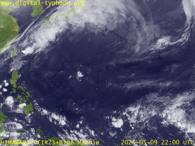
RECENT MTSAT-1R SATELLITE IMAGE:

> Image source: Digital-Typhoon.org (Nat'l. Institute of Informatics) (http://www.digital-typhoon.org )
__________________________________________________________________________________________
NOTES:

> Image source: Digital-Typhoon.
^ - JTWC commentary remarks (for Meteorologists) from their
latest warning.
latest warning.
* - Based on PAGASA's Philippine Storm Warning Signals,
# 4 being the highest. Red letters indicate new areas
being hoisted. For more explanations on these signals,
visit: http://www.typhoon2000.ph/signals.htm
** - Based on the Tropical Cyclone's Wave Height near
its center.
__________________________________________________________________________________________
>> To know the meteorological terminologies and acronyms
used on this update visit the ff:
http://typhoon2000.ph/tcterm.htm
http://www.nhc.noaa.gov/aboutgloss.shtml
http://www.srh.noaa.gov/oun/severewx/glossary.php
http://www.srh.weather.gov/fwd/glossarynation.html
http://www.nhc.noaa.gov/acronyms.shtml
__________________________________________________________________________________________
:: Typhoon2000.com (T2K) Mobile >> Powered by: Synermaxx
Receive the latest storm updates directly to your mobile phones! To know more:
Send T2K HELP to: 2800 (GLOBE & TM) | 216 (SMART & TNT) | 2288 (SUN)
Note: Globe & Smart charges P2.50 per message, while Sun at P2.00.
__________________________________________________________________________________________
For the complete details on TS KROSA (INENG)...go visit
our website @:
> http://www.typhoon2000.com
> http://www.maybagyo.com
# 4 being the highest. Red letters indicate new areas
being hoisted. For more explanations on these signals,
visit: http://www.typhoon2
** - Based on the Tropical Cyclone's Wave Height near
its center.
____________
>> To know the meteorological terminologies and acronyms
used on this update visit the ff:
http://typhoon2000.
http://www.nhc.
http://www.srh.
http://www.srh.
http://www.nhc.
____________
:: Typhoon2000.
Receive the latest storm updates directly to your mobile phones! To know more:
Send T2K HELP to: 2800 (GLOBE & TM) | 216 (SMART & TNT) | 2288 (SUN)
Note: Globe & Smart charges P2.50 per message, while Sun at P2.00.
For the complete details on TS KROSA (INENG)...go visit
our website @:
> http://www.typhoon2
> http://www.maybagyo
Change settings via the Web (Yahoo! ID required)
Change settings via email: Switch delivery to Daily Digest | Switch format to Traditional
Visit Your Group | Yahoo! Groups Terms of Use | Unsubscribe
.
__,_._,___
No comments:
Post a Comment