Typhoon2000 STORM UPDATE #005
Name: TYPHOON NEOGURI [AMBO/02W/0801]
Issued: 7:00 AM MANILA TIME (23:00 GMT) FRI 18 APRIL 2008
Source: JTWC TROPICAL CYCLONE WARNING NUMBER 016
Note: Kindly refer to your country's official warnings or bulletins. This update is for additional information purposes only.
Source: JTWC TROPICAL CYCLONE WARNING NUMBER 016
Note: Kindly refer to your country's official warnings or bulletins. This update is for additional information purposes only.
_____________________________________________________________________________
TYPHOON NEOGURI (AMBO) GAINED MORE STRENGTH...NEARS CATEGORY THREE
STATUS...APPROACHING THE EASTERN SHORES OF HAINAN...ENDANGERS WESTERN
GUANGDONG (CHINA).
+ FORECAST OUTLOOK: NEOGURI is expected to continue moving North along
the eastern coast of Hainan within the next 1 and a half day and shall
make landfall over the Western Guangdong Province of China tomorrow
afternoon (approx 2PM HK time) and weaken into a storm. The core (eye
& eyewall) shall pass very close to the Eastern shoreline of Hainan
around midnight tonight. The 2-day forecast shows NEOGURI turning on
a NNE'ly track across Mainland China on Sunday, Apr 20 and dissipating
on Monday, April 21.
+ EFFECTS: NEOGURI's strong compact circulation remains over the South-
eastern Coast of Hainan. The inner bands of this typhoon is now affec-
ting the eastern shoreline of Hainan - bringing moderate to heavy rains
accompanied with gale force winds reaching 85 km/hr. Meanwhile, Its
outer bands continues to spread across the whole of Hainan and the
coastal areas of Southern China. These bands will continue to bring
widespread rains with light to moderate winds across the area today.
Deteriorating weather conditions can be expected later today until
tomorrow as the typhoon's inner bands and its core moves closer to
Eastern Hainan and Western Guangdong. People living in low-lying areas
of Hainan and Southern China must seek higher grounds for possible
flooding due to the anticipated heavy rains brought about by this storm.
Precautionary measures must be implemented. Coastal Storm Surge floo-
ding of 6 to 8 feet above normal tide levels...along with large and
dangerous battering waves can be expected near and to the north of
NEOGURI's projected path particularly on where the center makes land-
fall in Eastern Hainan/Western Guangdong. Moderate damage is possible
on this type of storm surge. Far-fetched storm surge is also possible
along coastal areas of Eastern Vietnam & Southern China.
Important Note: Please keep in mind that the above forecast outlook,
effects & current monsoon intensity, and tropical cyclone watch changes
every 06 to 12 hours!
_____________________________________________________________________________
TIME/DATE: 5:00 AM MANILA TIME (21:00 GMT) 18 APRIL
LOCATION OF EYE: LATITUDE 17.5º N...LONGITUDE 111.8º E
DISTANCE 1: 235 KM (127 NM) SE OF QIONGHAI, HAINAN IS.
effects & current monsoon intensity, and tropical cyclone watch changes
every 06 to 12 hours!
____________
LOCATION OF EYE: LATITUDE 17.5º N...LONGITUDE 111.8º E
DISTANCE 1: 235 KM (127 NM) SE OF QIONGHAI, HAINAN IS.
DISTANCE 2: 255 KM (137 NM) ESE OF SANYA, HAINAN IS.
DISTANCE 3: 330 KM (180 NM) SSE OF HAIKOU, HAINAN IS.
DISTANCE 4: 445 KM (240 NM) SSE OF ZHANJIANG, CHINA
DISTANCE 5: 555 KM (300 NM) SSW OF MACAU, CHINA
MAX WINDS [1-MIN AVG]: 175 KM/HR (95 KTS) NEAR THE CENTER
PEAK WIND GUSTS: 215 KM/HR (115 KTS)
SAFFIR-SIMPSON SCALE: CATEGORY TWO (2)
MINIMUM CENTRAL PRESSURE (est.): 952 MILLIBARS (hPa)
RECENT MOVEMENT: NORTH @ 11 KM/HR (06 KTS)
GENERAL DIRECTION: EASTERN HAINAN-WESTERN GUANGDONG
STORM'S SIZE (IN DIAMETER): 705 KM (380 NM)/LARGE
MAX WAVE HEIGHT**: 26 FEET (7.9 METERS)
VIEW TRACKING MAP: 2 AM MANILA TIME FRI APRIL 18
TSR WIND PROBABILITIES: CURRENT TO 72 HRS LEAD
PHILIPPINE STORM SIGNALS*: NONE
12, 24 & 48 HR. FORECAST:
2 PM (06 GMT) 18 APRIL: 18.6N 111.7E / 165-205 KPH / N @ 15 KPH
2 AM (18 GMT) 19 APRIL: 20.1N 111.5E / 140-165 KPH / N @ 15 KPH
2 AM (18 GMT) 20 APRIL: 23.7N 112.4E / 75-95 KPH / NNE @ 20 KPH
_____________________________________________________________________________
____________
_____________________________________________________________________________
RECENT WUNDERGROUND.COM TRACKING CHART :
RECENT WUNDERGROUND.
________________________
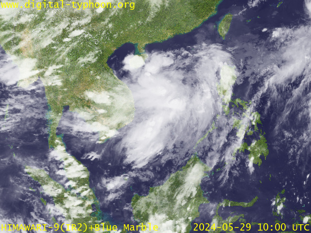
RECENT MTSAT-1R SATELLITE IMAGE:

> Image source: Digital-Typhoon.org (Nat'l. Institute of Informatics) (http://www.digital-typhoon.org )
__________________________________________________________________________________________
NOTES:

> Image source: Digital-Typhoon.
^ - JTWC commentary remarks (for Meteorologists) from their
latest warning.
latest warning.
* - Based on PAGASA's Philippine Storm Warning Signals,
# 4 being the highest. Red letters indicate new areas
being hoisted. For more explanations on these signals,
visit: http://www.typhoon2000.ph/signals.htm
** - Based on the Tropical Cyclone's Wave Height near
its center.
__________________________________________________________________________________________
>> To know the meteorological terminologies and acronyms
used on this update visit the ff:
http://typhoon2000.ph/tcterm.htm
http://www.nhc.noaa.gov/aboutgloss.shtml
http://www.srh.noaa.gov/oun/severewx/glossary.php
http://www.srh.weather.gov/fwd/glossarynation.html
http://www.nhc.noaa.gov/acronyms.shtml
__________________________________________________________________________________________
:: Typhoon2000.com (T2K) Mobile >> Powered by: Synermaxx
Receive the latest storm updates directly to your mobile phones! To know more:
Send T2K HELP to: 2800 (GLOBE & TM) | 216 (SMART & TNT) | 2288 (SUN)
Note: Globe & Smart charges P2.50 per message, while Sun at P2.00.
__________________________________________________________________________________________
For the complete details on TY NEOGURI (AMBO)...go visit
our website @:
> http://www.typhoon2000.com
> http://www.maybagyo.com
# 4 being the highest. Red letters indicate new areas
being hoisted. For more explanations on these signals,
visit: http://www.typhoon2
** - Based on the Tropical Cyclone's Wave Height near
its center.
____________
>> To know the meteorological terminologies and acronyms
used on this update visit the ff:
http://typhoon2000.
http://www.nhc.
http://www.srh.
http://www.srh.
http://www.nhc.
____________
:: Typhoon2000.
Receive the latest storm updates directly to your mobile phones! To know more:
Send T2K HELP to: 2800 (GLOBE & TM) | 216 (SMART & TNT) | 2288 (SUN)
Note: Globe & Smart charges P2.50 per message, while Sun at P2.00.
For the complete details on TY NEOGURI (AMBO)...go visit
our website @:
> http://www.typhoon2
> http://www.maybagyo
Copyright © 2008 Typhoon2000.
Change settings via the Web (Yahoo! ID required)
Change settings via email: Switch delivery to Daily Digest | Switch format to Traditional
Visit Your Group | Yahoo! Groups Terms of Use | Unsubscribe
.
__,_._,___
No comments:
Post a Comment