Typhoon2000 STORM UPDATE #008
Name: TYPHOON NURI [KAREN/13W/0812]
Issued: 1:00 PM MANILA TIME (05:00 GMT) WED 20 AUGUST 2008
Source: JTWC TROPICAL CYCLONE WARNING NUMBER 013
Note: Kindly refer to your country's official warnings or bulletins. This update is for additional information purposes only.
Source: JTWC TROPICAL CYCLONE WARNING NUMBER 013
Note: Kindly refer to your country's official warnings or bulletins. This update is for additional information purposes only.
_____________________________________________________________________________
TYPHOON NURI (KAREN) NOW CROSSING THE NORTHERN COAST OF EXTREME
NORTHERN LUZON...STRONG WINDS AND HEAVY RAINS CONTINUES TO LASH
BABUYAN-CALAYAN ISLANDS, NORTHERN CAGAYAN AND NORTHERN ILOCOS NORTE.
*This system continues to enhance the SW Monsoon Rains across Western & Southern
Luzon & Western Visayas including Metro Manila.
+ FORECAST OUTLOOK: NURI is expected to continue moving WNW for the next
*This system continues to enhance the SW Monsoon Rains across Western & Southern
Luzon & Western Visayas including Metro Manila.
+ FORECAST OUTLOOK: NURI is expected to continue moving WNW for the next
24 hours, with its eye and its eyewall passing across the Northern Coast
of Ilocos Norte this afternoon. It will move out into the South China Sea
later tonight. The 4-day medium-range forecast shows NURI gradually turning
NW across the South China Sea tomorrow, Aug 21 and shall make its final
landfall along the coast of Eastern Guangdong, more or less 150 km. East
of Hong Kong on Friday, Aug 22, around 11-12 PM w/ forecast winds of
almost 200 km/hr. NURI shall move inland across China and dissipate over
the area on Sunday, Aug 24.
+ EFFECTS: NURI's radial circulation and spiral bands continues to affect
+ EFFECTS: NURI's radial circulation and spiral bands continues to affect
the northern coast of Extreme Northern Luzon. Its Eyewall is currently
affecting Calayan-Babuyan Islands & the coast of Northern Cagayan - bri-
nging high winds and heavy rains of more or less 400 mm. The inner bands
of NURI is currently spreading across Extreme Northern Luzon - bringing
stormy weather of these areas. While its outer bands continues to cover
the whole of Northern & Central Luzon carrying winds and rains not excee-
ding 75 km/hr today. Residents in low-lying areas must seek higher grounds
for possible flooding & landslides due to the anticipated heavy rains
brought about by this disturbance. Precautionary measures must be initiated
if necessary. Possible coastal Storm Surge flooding of 6 to 8 feet above
normal tide levels...along with large and dangerous battering waves can be
expected near and to the north of NURI's projected path particularly when
the system moves over Extreme Northern Luzon. Moderate damage is possible
on this type of storm surge. Far-fetched storm surge is possible along
coastal areas of Eastern Luzon with surf reaching 3 feet at most.
+ CURRENT MONSOON TROUGH (ITCZ) INTENSITY: The Southwest (SW) Monsoon
+ CURRENT MONSOON TROUGH (ITCZ) INTENSITY: The Southwest (SW) Monsoon
continues to be enhanced by TY NURI (KAREN) affecting Southern & SW Luzon
including Metro Manila, Subic Bay & Western Visayas. This wind system is
expected to bring mostly cloudy skies with possible "on-&-off" light to
moderate to sometimes heavy rains & winds not exceeding 40 km/hr today.
Important Note: Please keep in mind that the above forecast outlook,
effects & current monsoon intensity, and tropical cyclone watch changes
every 06 to 12 hours!
_____________________________________________________________________________
TIME/DATE: 11:00 AM MANILA TIME (03:00 GMT) 20 AUGUST
LOCATION OF EYE: LATITUDE 18.9º N...LONGITUDE 121.4º E
DISTANCE 1: 45 KM (25 NM) SSW OF CALAYAN ISLAND, PH
DISTANCE 2: 65 KM (35 NM) NW OF APARRI, CAGAYAN, PH
DISTANCE 3: 115 KM (62 NM) NE OF LAOAG CITY, PH
effects & current monsoon intensity, and tropical cyclone watch changes
every 06 to 12 hours!
____________
LOCATION OF EYE: LATITUDE 18.9º N...LONGITUDE 121.4º E
DISTANCE 1: 45 KM (25 NM) SSW OF CALAYAN ISLAND, PH
DISTANCE 2: 65 KM (35 NM) NW OF APARRI, CAGAYAN, PH
DISTANCE 3: 115 KM (62 NM) NE OF LAOAG CITY, PH
DISTANCE 4: 190 KM (103 NM) SSW OF BASCO, BATANES, PH
MAX WINDS [1-MIN AVG]: 175 KM/HR (95 KTS) NEAR THE CENTER
PEAK WIND GUSTS: 215 KM/HR (115 KTS)
SAFFIR-SIMPSON SCALE: CATEGORY TWO (2)
MINIMUM CENTRAL PRESSURE (est.): 952 MILLIBARS (hPa)
RECENT MOVEMENT: WNW @ 20 KM/HR (11 KTS)
GENERAL DIRECTION: BABUYAN-CALAYAN AREA
STORM'S SIZE (IN DIAMETER): 720 KM (390 NM)/LARGE
MAX WAVE HEIGHT**: 24 FEET (7.3 METERS)
VIEW T2K TRACKING MAP: 5 AM MANILA TIME WED AUGUST 20
TSR WIND PROBABILITIES: CURRENT TO 96 HRS LEAD
PHILIPPINE STORM SIGNALS*:
#03 - CAGAYAN, APAYAO, CALAYAN, BATANES, BABUYAN, & ILOCOS NORTE.
#02 - ISABELA, LA UNION, BENGUET, NUEVA VIZCAYA, ILOCOS SUR, ABRA,
KALINGA, MT. PROVINCE, & IFUGAO.
#01 - PANGASINAN, PAMPANGA, TARLAC, ZAMBALES, QUIRINO, NUEVA ECIJA,
AND AURORA.
12, 24, 48 & 72 HR. FORECAST:
8 PM (12 GMT) 20 AUGUST: 19.4N 120.0E / 175-215 KPH / WNW @ 17 KPH
KALINGA, MT. PROVINCE, & IFUGAO.
#01 - PANGASINAN, PAMPANGA, TARLAC, ZAMBALES, QUIRINO, NUEVA ECIJA,
AND AURORA.
12, 24, 48 & 72 HR. FORECAST:
8 PM (12 GMT) 20 AUGUST: 19.4N 120.0E / 175-215 KPH / WNW @ 17 KPH
8 AM (00 GMT) 21 AUGUST: 20.2N 118.4E / 185-230 KPH / NW @ 17 KPH
8 AM (00 GMT) 22 AUGUST: 22.4N 115.9E / 195-240 KPH / NW @ 09 KPH
8 AM (00 GMT) 23 AUGUST: 24.0N 114.7E / 110-140 KPH / NNW @ 07 KPH
REMARKS: 8 AM (00 GMT) 20 AUGUST POSITION: 18.7N 121.9E.
^TY 13W (NURI) HAS NEARLY MAINTAINED INTENSITY OVER THE PAST
12 HOURS WHILE TRACKING GENERALLY WESTWARD ALONG THE SOUTHERN PERI-
PHERY OF A SUBTROPICAL RIDGE EXTENSION TO THE NORTH OF THE STORM.
A 20 NM EYE IS NOW EVIDENT IN MULTISPECTRAL AND WATER VAPOR SATELLITE
IMAGERY. AN UPPER LEVEL ANTICYCLONE OVER THE CYCLONE AND BROAD SCALE
EASTERLY FLOW ALOFT HAVE CONTINUED TO DRIVE STRONG EQUATORWARD AND
WESTWARD CONVECTIVE OUTFLOW. ADDITIONALLY, A WEAK UPPER LEVEL CYCLONE
TO THE WEST OF TY 13W HAS ENHANCED POLEARD OUTFLOW OVER THE PAST
12 HOURS. THE SOUTHERN PORTION OF THE LOW LEVEL CIRCULATION HAS
MOVED OVER NORTHERN LUZON, BUT THE EYE OF THE STORM REMAINS OFFSHORE
...(more)
>> NURI {pronounced: nu~ree}, meaning: Blue crowned parroquet in the
Malay language. Name contributed by: Malaysia.
_____________________________________________________________________________
PAGASA CURRENT POSITION, MOVEMENT AND INTENSITY (10-min. avg winds):
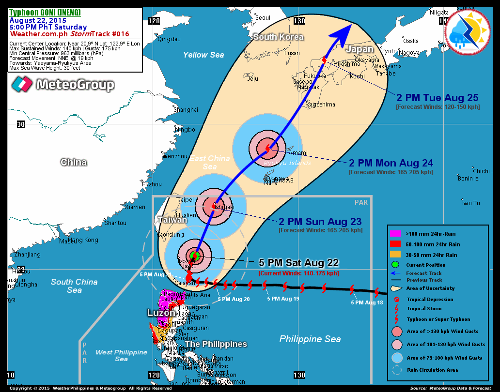
RECENT T2K TRACKING CHART:
8 AM (00 GMT) 23 AUGUST: 24.0N 114.7E / 110-140 KPH / NNW @ 07 KPH
REMARKS: 8 AM (00 GMT) 20 AUGUST POSITION: 18.7N 121.9E.
^TY 13W (NURI) HAS NEARLY MAINTAINED INTENSITY OVER THE PAST
12 HOURS WHILE TRACKING GENERALLY WESTWARD ALONG THE SOUTHERN PERI-
PHERY OF A SUBTROPICAL RIDGE EXTENSION TO THE NORTH OF THE STORM.
A 20 NM EYE IS NOW EVIDENT IN MULTISPECTRAL AND WATER VAPOR SATELLITE
IMAGERY. AN UPPER LEVEL ANTICYCLONE OVER THE CYCLONE AND BROAD SCALE
EASTERLY FLOW ALOFT HAVE CONTINUED TO DRIVE STRONG EQUATORWARD AND
WESTWARD CONVECTIVE OUTFLOW. ADDITIONALLY, A WEAK UPPER LEVEL CYCLONE
TO THE WEST OF TY 13W HAS ENHANCED POLEARD OUTFLOW OVER THE PAST
12 HOURS. THE SOUTHERN PORTION OF THE LOW LEVEL CIRCULATION HAS
MOVED OVER NORTHERN LUZON, BUT THE EYE OF THE STORM REMAINS OFFSHORE
...(more)
>> NURI {pronounced: nu~ree}, meaning: Blue crowned parroquet in the
Malay language. Name contributed by: Malaysia.
____________
PAGASA CURRENT POSITION, MOVEMENT AND INTENSITY (10-min. avg winds):
> 10 AM (02 GMT) 20 AUGUST: 18.9N 121.6E / WNW @ 17 KPH / 140 kph
:: For the complete PAGASA bulletin, kindly visit their website at:
http://www.pagasa.dost.gov.ph/wb/tcupdate.shtml
:: For the complete PAGASA bulletin, kindly visit their website at:
http://www.pagasa.
_____________________________________________________________________________
RECENT T2K TRACKING CHART:

________________________
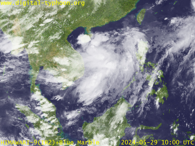
RECENT MTSAT-1R SATELLITE IMAGE:

> Image source: Digital-Typhoon.Org (http://www.digital-typhoon.org/ )
__________________________________________________________________________________________
NOTES:

> Image source: Digital-Typhoon.
^ - JTWC commentary remarks (for Meteorologists) from their
latest warning.
latest warning.
* - Based on PAGASA's Philippine Storm Warning Signals,
# 4 being the highest. For more explanations on these
signals, visit: http://www.typhoon2000.ph/signals.htm
** - Based on the Tropical Cyclone's Wave Height near
its center.
__________________________________________________________________________________________
>> To know the meteorological terminologies and acronyms
used on this update visit the ff:
http://typhoon2000.ph/tcterm.htm
http://www.nhc.noaa.gov/aboutgloss.shtml
http://www.srh.noaa.gov/oun/severewx/glossary.php
http://www.srh.weather.gov/fwd/glossarynation.html
http://www.nhc.noaa.gov/acronyms.shtml
__________________________________________________________________________________________
:: Typhoon2000.com (T2K) Mobile >> Powered by: Synermaxx
Receive the latest 6-hrly storm updates on KAREN directly to your mobile phones! To get:
Send T2K TYPHOON to: 2800 (GLOBE & TM) | 216 (SMART & TNT) | 2288 (SUN)
Note: Globe & Smart charges P2.50 per message, while Sun at P2.00.
__________________________________________________________________________________________
For the complete details on TY NURI (KAREN)...go visit
our website @:
> http://www.typhoon2000.com
> http://www.maybagyo.com
# 4 being the highest. For more explanations on these
signals, visit: http://www.typhoon2
** - Based on the Tropical Cyclone's Wave Height near
its center.
____________
>> To know the meteorological terminologies and acronyms
used on this update visit the ff:
http://typhoon2000.
http://www.nhc.
http://www.srh.
http://www.srh.
http://www.nhc.
____________
:: Typhoon2000.
Receive the latest 6-hrly storm updates on KAREN directly to your mobile phones! To get:
Send T2K TYPHOON to: 2800 (GLOBE & TM) | 216 (SMART & TNT) | 2288 (SUN)
Note: Globe & Smart charges P2.50 per message, while Sun at P2.00.
For the complete details on TY NURI (KAREN)...go visit
our website @:
> http://www.typhoon2
> http://www.maybagyo
Copyright © 2008 Typhoon2000.
Change settings via the Web (Yahoo! ID required)
Change settings via email: Switch delivery to Daily Digest | Switch format to Traditional
Visit Your Group | Yahoo! Groups Terms of Use | Unsubscribe
.
__,_._,___
No comments:
Post a Comment