Photos by MJ Klein
HUKOU, TAIWAN
This was never supposed to happen. The typhoon was supposed to miss us and head up to Japan. But instead, typhoon Sinlaku parked itself just off of Taiwan's east coast and then went on to scoop up moisture from the Pacific ocean and dump it on Taiwan in the form of heavy rains. The presence of this powerful typhoon has ruined plans for celebration of the Mid-Autumn Festival for millions of Taiwan residents.
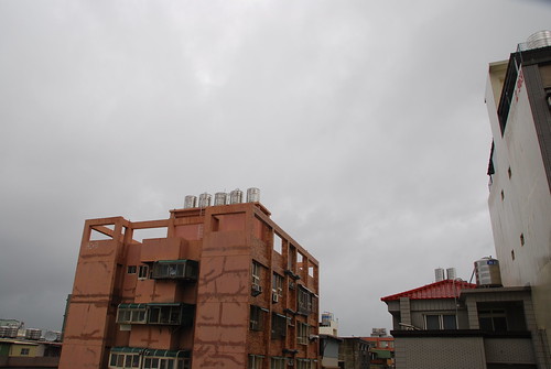
View facing east
![]()
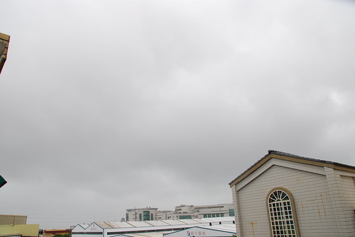
View facing west
Although this storm looks disorganized when the sky is viewed by eye, radar clearly shows that this storm is still very well organized and quite powerful:
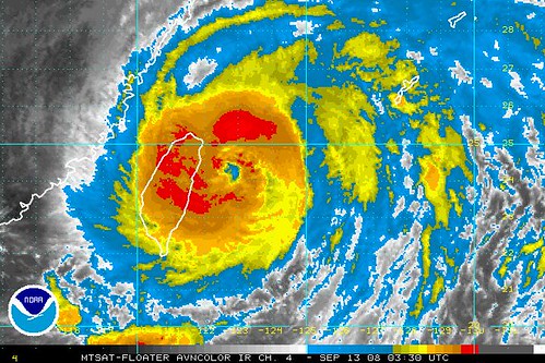
"SINLAKU has completed its Eyewall Replacement Cycle (ERC)
with the diminishment of its inner eyewall, thus further re-strengthe- ning of its wind speed is expected tomorrow, bringing it back to Cate- gory 4 status. The new eye now measures approximately 110 km across. The new northern eyewall (from the ERC) continues to lash the Yaeyama Island Chain with very strong winds and heavy rainfall. Its inner bands on the other hand has been covering the eastern part of Tai- wan...while the outer bands remains across the rest of Taiwan. Cloudy skies w/ at times moderate to heavy squalls with winds not exceeding 95 km/hr can be expected along its outer bands, with increasing winds and more pronounce rainfall within the inner bands. 1-day rainfall accumulations of up to 200-400 mm can be expected along these bands. Deteriorating weather conditions can be expected along Northern Taiwan as the core slowly approaches. Residents in low-lying areas & steep slopes must seek evacuation for possible life-threatening flash floods & landslides due to the anticipated heavy rains brought about by this system. Precautionary measures must be initiated if necessary. Possible coastal Storm Surge flooding of 9 to 12 feet above normal tide levels ...along with large and dangerous battering waves can be expected near and to the north of SINLAKU's projected path particularly on where the center passes by in Yaeyama Islands. Extensive damage is possible on this type of storm surge."
The worst is yet to come as this storm regroups off Taiwan's east coast and gains strength. 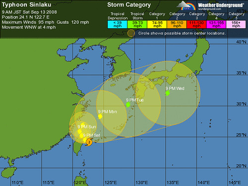

Tags: Environment | Taiwan | typhoon | Hukou | sinlaku

No comments:
Post a Comment