Typhoon2000 STORM UPDATE #009 **FINAL**
Name: TROPICAL DISTURBANCE EX-MAYSAK [QUINTA/24W/0819]
Issued: 1:00 PM MANILA TIME (05:00 GMT) WED 12 NOVEMBER 2008
Source: JTWC TROPICAL CYCLONE SATELLITE ANALYSIS
Note: Kindly refer to your country's official warnings or bulletins. This update is for additional information purposes only.
Source: JTWC TROPICAL CYCLONE SATELLITE ANALYSIS
Note: Kindly refer to your country's official warnings or bulletins. This update is for additional information purposes only.
_____________________________________________________________________________
MAYSAK (QUINTA) HAS WEAKENED INTO A TROPICAL DISTURBANCE (LPA)...RELOCATED
FARTHER TO THE WEST-SOUTHWEST OF ITS PREVIOUS POSITION...NO LONGER A
THREAT TO WESTERN PHILIPPINES.
*UNLESS REGENERATION OCCURS, THIS IS THE FINAL EMAIL UPDATE ON THIS SYSTEM.
+ FORECAST OUTLOOK: Ex-MAYSAK is expected to continue moving WSW in the
*UNLESS REGENERATION OCCURS, THIS IS THE FINAL EMAIL UPDATE ON THIS SYSTEM.
+ FORECAST OUTLOOK: Ex-MAYSAK is expected to continue moving WSW in the
direction of Southern Vietnam...A possible regeneration of this system is
likely if improved upper-level environment occurs.
+ EFFECTS: Ex-MAYSAK's scattered rainbands is now well in the middle of the
+ EFFECTS: Ex-MAYSAK's scattered rainbands is now well in the middle of the
South China Sea. These bands is expected to bring widespread rains with
passing moderate to strong squalls...with wind gusts not in excess of
enhanced by EX-MAYSAK (QUINTA) is currently affecting Northern and Central
Luzon including Metro Manila, Mindoro, Northern Palawan and Bicol Region.
Cloudy skies with light to moderate passing rains w/ at times heavy downpour
& NE'ly winds not exceeding 60 km/hr can be expected along the affected
areas. Landslides, mudslides, mudflows (lahars) and life-threatening flash
floods are likely to occur along steep mountain/volcanic slopes, river
banks, low-lying & flood-prone areas of the affected areas.
Important Note: Please keep in mind that the above forecast outlook,
effects & current monsoon intensity, and tropical cyclone watch changes
every 06 to 12 hours!
_____________________________________________________________________________
TIME/DATE: 11:00 AM MANILA TIME (03:00 GMT) WED 12 NOV 2008
LOCATION OF CENTER: LATITUDE 11.8º N...LONGITUDE 116.1º E
DISTANCE 1: 370 KM (200 NM) NW OF PUERTO PRINCESA, PALAWAN, PH
DISTANCE 2: 445 KM (240 NM) WEST OF CORON, PALAWAN, PH
effects & current monsoon intensity, and tropical cyclone watch changes
every 06 to 12 hours!
____________
LOCATION OF CENTER: LATITUDE 11.8º N...LONGITUDE 116.1º E
DISTANCE 1: 370 KM (200 NM) NW OF PUERTO PRINCESA, PALAWAN, PH
DISTANCE 2: 445 KM (240 NM) WEST OF CORON, PALAWAN, PH
DISTANCE 3: 610 KM (330 NM) SW OF MANILA, PH
DISTANCE 4: 750 KM (405 NM) ESE OF NHA TRANG, VIETNAM
MAX WINDS [1-MIN AVG]: 35 KM/HR (20 KTS) NEAR THE CENTER
PEAK WIND GUSTS: 55 KM/HR (30 KTS)
SAFFIR-SIMPSON SCALE: TROPICAL DISTURBANCE
COASTAL STORM SURGE HEIGHT: 0 FEET (0 METERS)
MINIMUM CENTRAL PRESSURE (est.): 1006 MILLIBARS (hPa)
RECENT MOVEMENT: WSW @ 15 KPH (08 KTS)
GENERAL DIRECTION: SOUTHERN VIETNAM
STORM'S SIZE (IN DIAMETER): 370 KM (200 NM)/AVERAGE
MAX WAVE HEIGHT**: 13 FEET (3.9 METERS)
PHILIPPINE STORM SIGNALS*: NONE
>> MAYSAK, meaning: A kind of tree. Name contributed by: Cambodia.
____________
_____________________________________________________________________________
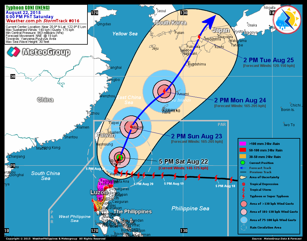
RECENT T2K TRACKING CHART:

________________________
RECENT MTSAT-1R SATELLITE IMAGE:

> Image source: NOAA Satellite Service (http://www.noaa.gov/ )
__________________________________________________________________________________________
NOTES:

> Image source: NOAA Satellite Service (http://www.noaa.
____________
^ - JTWC commentary remarks (for Meteorologists) from their
latest warning.
latest warning.
* - Based on PAGASA's Philippine Storm Warning Signals,
# 4 being the highest. For more explanations on these
signals, visit: http://www.typhoon2000.ph/signals.htm
** - Based on the Tropical Cyclone's Wave Height near
its center.
__________________________________________________________________________________________
>> To know the meteorological terminologies and acronyms
used on this update visit the ff:
http://typhoon2000.ph/tcterm.htm
http://www.nhc.noaa.gov/aboutgloss.shtml
http://www.srh.noaa.gov/oun/severewx/glossary.php
http://www.srh.weather.gov/fwd/glossarynation.html
http://www.nhc.noaa.gov/acronyms.shtml
__________________________________________________________________________________________
:: Typhoon2000.com (T2K) Mobile >> Powered by: Synermaxx
Receive the latest 6-hrly storm updates directly to your mobile phones! To get:
Send T2K TYPHOON to: 2800 (GLOBE & TM) | 216 (SMART & TNT) | 2288 (SUN)
Note: Globe & Smart charges P2.50 per message, while Sun at P2.00.
__________________________________________________________________________________________
For the complete details on TD EX-MAYSAK (QUINTA)...go visit
our website @:
> http://www.typhoon2000.com
> http://www.maybagyo.com
# 4 being the highest. For more explanations on these
signals, visit: http://www.typhoon2
** - Based on the Tropical Cyclone's Wave Height near
its center.
____________
>> To know the meteorological terminologies and acronyms
used on this update visit the ff:
http://typhoon2000.
http://www.nhc.
http://www.srh.
http://www.srh.
http://www.nhc.
____________
:: Typhoon2000.
Receive the latest 6-hrly storm updates directly to your mobile phones! To get:
Send T2K TYPHOON to: 2800 (GLOBE & TM) | 216 (SMART & TNT) | 2288 (SUN)
Note: Globe & Smart charges P2.50 per message, while Sun at P2.00.
For the complete details on TD EX-MAYSAK (QUINTA)...go visit
our website @:
> http://www.typhoon2
> http://www.maybagyo
Copyright © 2008 Typhoon2000.
Change settings via the Web (Yahoo! ID required)
Change settings via email: Switch delivery to Daily Digest | Switch format to Traditional
Visit Your Group | Yahoo! Groups Terms of Use | Unsubscribe
.
__,_._,___
No comments:
Post a Comment