
for Wednesday, 21 October 2009 [12:57 AM PST]


<<<Typhoon2000.com Mobile >>>
Get the latest 6-hrly SMS Storm Alerts on RAMIL!
For more details: Text T2K TYPHOON to
2800 (Globe/TM) | 216 (Smart/TNT) | 2288 (Sun)
*only P2.50 (Smart/Globe) / P2.00 (Sun) per msg received.
powered by: Synermaxx
Typhoon2000 (T2K) NEWS (Wed October 21 2009):
Technical difficulties being encountered on our SMS (Text) service...being fixed now. Continuing issuing 6-hrly advisories (except 12:00 AM) on TY LUPIT (RAMIL)
LUPIT (RAMIL) MAX WIND SPEED PER AGENCY:
+ Philippines (PAGASA/10-min avg): 175 km/hr
+ Beijing (NMC/2-min avg): 165 kph
+ Hong Kong (HKO/10-min avg): 160 km/hr
+ USA (JTWC/1-min avg): 150 km/hr
+ Taiwan (CWB/10-min avg): 145 km/hr
+ Korea (KMA/10-min avg): 140 km/hr
+ Japan (JMA/10-min avg): 130 km/hr
TYPHOON LUPIT [RAMIL/22W/0920]
T2K PUBLIC ADVISORY NUMBER 022
12:00 PM PST (04:00 GMT) Wed 21 October 2009
Source: T2K ANALYSIS / JTWC WARNING #029
View: Advisory Archives (2004-2009)
Typhoon LUPIT (RAMIL) downgraded into a Category 1 system with winds of 150 kph...moving WSW in the direction of Extreme Northern Luzon. Outer rainbands to reach the area tonight.
*Residents and visitors along Northern Luzon & Taiwan should closely monitor the progress of LUPIT (RAMIL).
*Kindly refer to your local warnings & bulletins issued by your country's official weather agency. This advisory is intended for additional information purposes only.
+ Forecast Outlook: LUPIT is expected to decelerate as it tracks WSW w/in the next 12 to 24 hours. Its wind speed will slightly strengthen back to Category 2 (165 kph) as it moves closer to the coast of Northeastern Luzon due to improved atmospheric conditions (warm ocean moisture & unstable air). The 2 to 5-day Long-Range Forecast shows LUPIT making landfall over the northern coast of Cagayan on Saturday morning, Oct 24 approx. 7-8AM - crossing Apayao and Ilocos Norte throughout Saturday. The core shall be off Laoag City on Sunday morning Oct 25 at around 7-8 AM. By Monday morning, Oct 26, LUPIT shall be moving slowly across the South China Sea, away from Ilocos Norte. *Alternate Forecast Scenario: There is a possibility that LUPIT might track Westward passing thru the Balintang Channel and spare Cagayan & Ilocos Norte from a direct hit, then move NW to Northward into Taiwan or SE China. This scenario is likely as some models deviates from the abovementioned forecast. The probability of this alternate forecast remains high, so a possible shift can happen. Please be reminded that the Forecast Outlook changes every 6 hours, so a turn to the left or right of its future track and other conditions must be considered. So please stay tuned.
+ Effects: LUPIT's circulation remains organized & large with a cloud-filled EYE. The outer & inner rain bands remains at sea...not yet affecting any major islands at this time, however, LUPIT may begin to affect Extreme Northern Luzon beginning tonight - if the forecast movement continues...deteriorating weather conditions can be expected within the next 48 to 72 hours. 1-day rainfall accumulations of 75 up to 200 mm (moderate to heavy rain) can be expected along its rainbands...with isolated accumulations of 400 mm or more (very heavy to extreme rain) near the center of LUPIT particularly along its projected path. Residents in low-lying areas & steep slopes must remain alert & seek evacuation for possible life-threatening flash floods, mudslides & landslides due to the anticipated heavy rains brought about by this system. Precautionary measures must be initiated if necessary. Possible coastal Storm Surge flooding of 4 to 5 feet above normal tide levels...accompanied by large and dangerous battering waves...is possible along the coastal areas of Extreme Northern Luzon especially along Cagayan, Batanes-Calayan-Babuyan Island Group, Isabela & Ilocos Norte. Very minimal damage is likely on this type of storm surge. Danger from Rip Currents or Rip Tides can be expected along the beach-front areas of Northern Luzon & Taiwan.
[Important Note: Please keep in mind that the above forecast outlook, effects, current monsoon intensity, & tropical cyclone watch changes every 6 to 12 hrs!]
Time/Date: 12:00 PM PST Wed October 21 2009
Location of Eye: 19.8º N Lat 126.6º E Lon
Distance 1: 485 km (262 nm) ESE of Basco, Batanes
Distance 2: 540 km (290 nm) ENE of Aparri, Cagayan
Distance 3: 570 km (307 nm) ENE of Tuguegarao City
Distance 4: 585 km (315 nm) NE of Ilagan City
Distance 5: 620 km (335 nm) NE of Casiguran, Aurora
Distance 6: 655 km (355 nm) ENE of Laoag City
Distance 7: 780 km (420 nm) NNE of Naga City
Distance 8: 820 km (443 nm) NE of Metro Manila
MaxWinds (1-min avg): 150 kph (80 kts) near the Eye
Peak Wind Gusts: 185 kph (100 kts)
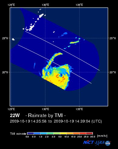
Rainbands' Rain Rate: 2 to 30 mm/hr (.02 to 1.2 in/hr) new!
Saffir-Simpson Typhoon Scale: Category 1
Coastal Storm Surge Height: 4-5 feet [1.2-1.7 m]
Minimum Central Pressure: 963 millibars (hPa)
Recent Movement: WSW @ 15 kph (08 kts)
Projected Area of Impact: Cagayan-Ilocos Norte
Size (in Diameter): 890 km (480 nm) / Very Large
Max Sea Wave Height (near center): 33 ft (10.0 m)
JTWC Ship Avoidance TrackMap: 8 AM Wed Oct 21
Multi-Agency Forecast TrackMap: 8 AM Wed Oct 21
TSR Wind Probabilities: Current to 5-days Ahead
NASA-JAXA TMI Image: Latest Rainrate 01
EORC-JAXA TRMM Image: Latest Rainrate 02
Zoomed Satellite Pic: Near Real-Time
Wunderground Animation: 6-12 hr. GIF Loop
PHILIPPINE STORM SIGNAL # THREE (3)
Now In Effect: NORTHERN CAGAYAN & CALAYAN-BABUYAN-BATANES ISLAND GROUP.
PHILIPPINE STORM WARNING SIGNAL # TWO (2)
Now In Effect: ILOCOS NORTE, APAYAO, REST OF CAGAYAN, ABRA, KALINGA, & ISABELA.
The above areas will experience stormy weather beginning tonight or tomorrow (with winds not exceeding 100 kph for #02 and more than 100 kph for #03). Coastal waters will be rough to very rough and extremely dangerous to all types of seacrafts.
PHILIPPINE STORM WARNING SIGNAL # ONE (1)
In Effect: ILOCOS SUR, MT. PROVINCE, IFUGAO, BENGUET, LA UNION, NUEVA VIZCAYA, QUIRINO, AURORA, NORTHERN QUEZON, & POLILLO ISLANDS.
The above areas will have rains and winds of not more than 60 kph beginning tonight or tomorrow. Coastal waters will be moderate to rough.
Residents living in low-lying and mountainous areas under Public Storm Warning Signal Numbers 3, 2 & 1 are alerted against flashfloods, mudflows, mudslides and landslides...while those living in coastal & beach-front areas are advised to seek higher grounds due to possible storm surge (aka. big waves) that could reach a high of 5 feet or more.
JTWC (US NAVY / AIR FORCE) 12, 24, 48 & 72 HR. FORECAST & REMARKS:
8 PM (12 GMT) 21 OCTOBER: 19.5N 125.6E / 160-195 KPH (TY-Cat 2) / WSW @ 11 KPH
<<<Typhoon2000.
Get the latest 6-hrly SMS Storm Alerts on RAMIL!
For more details: Text T2K TYPHOON to
2800 (Globe/TM) | 216 (Smart/TNT) | 2288 (Sun)
*only P2.50 (Smart/Globe) / P2.00 (Sun) per msg received.
powered by: Synermaxx
Typhoon2000 (T2K) NEWS (Wed October 21 2009):
Technical difficulties being encountered on our SMS (Text) service...being fixed now. Continuing issuing 6-hrly advisories (except 12:00 AM) on TY LUPIT (RAMIL)
LUPIT (RAMIL) MAX WIND SPEED PER AGENCY:
+ Philippines (PAGASA/10-min avg): 175 km/hr
+ Beijing (NMC/2-min avg): 165 kph
+ Hong Kong (HKO/10-min avg): 160 km/hr
+ USA (JTWC/1-min avg): 150 km/hr
+ Taiwan (CWB/10-min avg): 145 km/hr
+ Korea (KMA/10-min avg): 140 km/hr
+ Japan (JMA/10-min avg): 130 km/hr
TYPHOON LUPIT [RAMIL/22W/0920]
T2K PUBLIC ADVISORY NUMBER 022
12:00 PM PST (04:00 GMT) Wed 21 October 2009
Source: T2K ANALYSIS / JTWC WARNING #029
View: Advisory Archives (2004-2009)
*Residents and visitors along Northern Luzon & Taiwan should closely monitor the progress of LUPIT (RAMIL).
*Kindly refer to your local warnings & bulletins issued by your country's official weather agency. This advisory is intended for additional information purposes only.
+ Forecast Outlook: LUPIT is expected to decelerate as it tracks WSW w/in the next 12 to 24 hours. Its wind speed will slightly strengthen back to Category 2 (165 kph) as it moves closer to the coast of Northeastern Luzon due to improved atmospheric conditions (warm ocean moisture & unstable air). The 2 to 5-day Long-Range Forecast shows LUPIT making landfall over the northern coast of Cagayan on Saturday morning, Oct 24 approx. 7-8AM - crossing Apayao and Ilocos Norte throughout Saturday. The core shall be off Laoag City on Sunday morning Oct 25 at around 7-8 AM. By Monday morning, Oct 26, LUPIT shall be moving slowly across the South China Sea, away from Ilocos Norte. *Alternate Forecast Scenario: There is a possibility that LUPIT might track Westward passing thru the Balintang Channel and spare Cagayan & Ilocos Norte from a direct hit, then move NW to Northward into Taiwan or SE China. This scenario is likely as some models deviates from the abovementioned forecast. The probability of this alternate forecast remains high, so a possible shift can happen. Please be reminded that the Forecast Outlook changes every 6 hours, so a turn to the left or right of its future track and other conditions must be considered. So please stay tuned.
+ Effects: LUPIT's circulation remains organized & large with a cloud-filled EYE. The outer & inner rain bands remains at sea...not yet affecting any major islands at this time, however, LUPIT may begin to affect Extreme Northern Luzon beginning tonight - if the forecast movement continues...
Time/Date: 12:00 PM PST Wed October 21 2009
Location of Eye: 19.8º N Lat 126.6º E Lon
Distance 1: 485 km (262 nm) ESE of Basco, Batanes
Distance 2: 540 km (290 nm) ENE of Aparri, Cagayan
Distance 3: 570 km (307 nm) ENE of Tuguegarao City
Distance 4: 585 km (315 nm) NE of Ilagan City
Distance 5: 620 km (335 nm) NE of Casiguran, Aurora
Distance 6: 655 km (355 nm) ENE of Laoag City
Distance 7: 780 km (420 nm) NNE of Naga City
Distance 8: 820 km (443 nm) NE of Metro Manila
MaxWinds (1-min avg): 150 kph (80 kts) near the Eye
Peak Wind Gusts: 185 kph (100 kts)
Rainbands' Rain Rate: 2 to 30 mm/hr (.02 to 1.2 in/hr) new!
Saffir-Simpson Typhoon Scale: Category 1
Coastal Storm Surge Height: 4-5 feet [1.2-1.7 m]
Minimum Central Pressure: 963 millibars (hPa)
Recent Movement: WSW @ 15 kph (08 kts)
Projected Area of Impact: Cagayan-Ilocos Norte
Size (in Diameter): 890 km (480 nm) / Very Large
Max Sea Wave Height (near center): 33 ft (10.0 m)
JTWC Ship Avoidance TrackMap: 8 AM Wed Oct 21
Multi-Agency Forecast TrackMap: 8 AM Wed Oct 21
TSR Wind Probabilities: Current to 5-days Ahead
NASA-JAXA TMI Image: Latest Rainrate 01
EORC-JAXA TRMM Image: Latest Rainrate 02
Zoomed Satellite Pic: Near Real-Time
Wunderground Animation: 6-12 hr. GIF Loop
PHILIPPINE STORM SIGNAL # THREE (3)
Now In Effect: NORTHERN CAGAYAN & CALAYAN-BABUYAN-
PHILIPPINE STORM WARNING SIGNAL # TWO (2)
Now In Effect: ILOCOS NORTE, APAYAO, REST OF CAGAYAN, ABRA, KALINGA, & ISABELA.
The above areas will experience stormy weather beginning tonight or tomorrow (with winds not exceeding 100 kph for #02 and more than 100 kph for #03). Coastal waters will be rough to very rough and extremely dangerous to all types of seacrafts.
PHILIPPINE STORM WARNING SIGNAL # ONE (1)
In Effect: ILOCOS SUR, MT. PROVINCE, IFUGAO, BENGUET, LA UNION, NUEVA VIZCAYA, QUIRINO, AURORA, NORTHERN QUEZON, & POLILLO ISLANDS.
The above areas will have rains and winds of not more than 60 kph beginning tonight or tomorrow. Coastal waters will be moderate to rough.
Residents living in low-lying and mountainous areas under Public Storm Warning Signal Numbers 3, 2 & 1 are alerted against flashfloods, mudflows, mudslides and landslides..
8 PM (12 GMT) 21 OCTOBER: 19.5N 125.6E / 160-195 KPH (TY-Cat 2) / WSW @ 11 KPH
8 AM (00 GMT) 22 OCTOBER: 19.1N 124.4E / 165-205 KPH (TY-Cat 3) / WSW @ 09 KPH
8 AM (00 GMT) 23 OCTOBER: 18.6N 122.5E / 150-185 KPH (TY-Cat 1) / W @ 05 KPH
8 AM (00 GMT) 24 OCTOBER: 18.4N 121.4E / 130-160 KPH (TY-Cat 1) / W @ 04 KPH -- LANDFALL
8 AM (00 GMT) 23 OCTOBER: 18.6N 122.5E / 150-185 KPH (TY-Cat 1) / W @ 05 KPH
8 AM (00 GMT) 24 OCTOBER: 18.4N 121.4E / 130-160 KPH (TY-Cat 1) / W @ 04 KPH -- LANDFALL
REMARKS: 8 AM (00 GMT) WED 21 OCTOBER POSITION: 20.1N 127.0E.
*THE INTERNAL STRUCTURE OF THE TYPHOON HAS NOT YET FULLY
RECOVERED AFTER CONTENDING WITH A SLOT OF DRIER, MORE STABLE AIR AND
UNDERGOING AN EYEWALL REPLACEMENT CYCLE. HOWEVER, A LARGE EYE
FEATURE, THOUGH OBSCURED IN MULTISPECTRAL SATELLITE IMAGERY, REMAINS
EVIDENT IN RECENT MICROWAVE SATELLITE IMAGERY INCLUDING THE 202310Z
SSMIS PASS...(more)
>> LUPIT, meaning: Cruel; viciousness. Name contributed by: Philippines.
____________
PAGASA CURRENT POSITION, MOVEMENT AND INTENSITY (10-min. ave.):
> 10 AM (02 GMT) 21 OCTOBER: 20.1N 126.8E / WSW @ 15 kph / 175 kph
:: For the complete PAGASA bulletin, kindly visit their website at:
http://www.pagasa.dost.gov.ph/wb/tcupdate.shtml
_______________________________________________________________________________________________________________________________________
:: For the complete PAGASA bulletin, kindly visit their website at:
http://www.pagasa.
____________
RECENT TYPHOON2000.

________________________
RECENT MTSAT-1R SATELLITE IMAGE:

> Image source: NOAA SATELLITE CENTER
RECENT WUNDERGROUND SATELLITE ANIMATION:

> Image source: Wunderground.com (http://www.wunderground.com/ ) ____________________________________________________________________________________________________________________
> Image source: NOAA SATELLITE CENTER
____________________________________________________________________________________________________________________
RECENT WUNDERGROUND SATELLITE ANIMATION:
> Image source: Wunderground.
NOTE:
^ - JTWC commentary remarks (for Meteorologists) from their latest warning.
__________________________________________________________________________________________
>> To know the meteorological terminologies and acronyms used on this update visit the ff:
http://typhoon2000.ph/tcterm.htm
http://www.nhc.noaa.gov/aboutgloss.shtml
http://www.srh.noaa.gov/oun/severewx/glossary.php
http://www.srh.weather.gov/fwd/glossarynation.html
http://www.nhc.noaa.gov/acronyms.shtml
__________________________________________________________________________________________
For the complete details on TY LUPIT (RAMIL)...go visit our website @:
> http://www.typhoon2000.com
> http://www.maybagyo.com
>> To know the meteorological terminologies and acronyms used on this update visit the ff:
http://typhoon2000.
http://www.nhc.
http://www.srh.
http://www.srh.
http://www.nhc.
____________
> http://www.typhoon2
> http://www.maybagyo
Copyright © 2009 Typhoon2000.
__._,_.___
Change settings via the Web (Yahoo! ID required)
Change settings via email: Switch delivery to Daily Digest | Switch format to Traditional
Visit Your Group | Yahoo! Groups Terms of Use | Unsubscribe
.
__,_._,___

No comments:
Post a Comment